Local · Levada
CALHETA · PRAZERES → PAUL DO MAR
Local · VEREDA DO JARDIM DO MAR · 8.5 km · 3 h 15 min · Free
Vereda do Jardim do Mar
DEMANDING · CALHETA · 550 M DESCENT AND ASCENT
Distance
8.5 km
3 h 15 min · 550 m descent and ascent
IFCN Fee
Free
Return to Car
—
Area / Difficulty
Calheta · Demanding
Status note. 12 October 2026: 8.5 km, demanding coastal loop, 3 h 15 min. Not an IFCN figure. IFCN does not maintain this walk. Updated 12 Oct 2026.
Prazeres
Start · Calheta
8.5 km Channel
3 h 15 min · 550 m descent and ascent
Paul do Mar
Turnaround / Finish · Unpatrolled Local Path · No IFCN Maintenance
START BEFORE 08:30 AM AT PRAZERES FOR CLEAREST VISIBILITY & EASIEST PARKING
POINT-TO-POINT ROUTE (PRAZERES → PAUL DO MAR) — PLAN RETURN TAXI OR TURN AROUND AT MIDPOINT
NO IFCN PERMIT FEE REQUIRED ON THIS ROUTE — CHECK LIVE WEATHER & ROCKFALL ALERTS BEFORE DEPARTURE
Vereda do Jardim do Mar is 8.5 km, demanding coastal loop. Not on the IFCN list.
Interactive Field Calculators & Logistics Tools (Shuttle, Cost, Microclimate & Offline Card)
Closure & Congestion Mitigation
Twin-Trail & Plan-B Engine
Because parts of Vereda do Jardim do Mar are currently restricted or closed under IFCN decree, hike these verified open twin routes with matching terrain DNA, elevation drama, and scenery.
PR 8 Ponta de São Lourenço
Iconic open coastal trail with ocean views
PR 11 Vereda dos Balcões
Accessible viewpoint walk through native forest
Field Logistics Intelligence
Return-to-Car & Linear Loop Solver
Self-contained vehicle loop: this route safely returns directly to your starting parking bay at Prazeres.
Self-Contained Vehicle Return
This trail is an out-and-back or circular loop that terminates at the same parking area where you started (Prazeres). No taxi, public bus transfer, or multi-car shuttle required.
Coordination & Taxi-Split Action
Send this verified return plan to your group via WhatsApp or SMS.
Field Hazard & Body Impact Intelligence
Reality Matrix: Tunnels, Vertigo & Knee Strain
Beyond generic difficulty ratings: quantitative engineering metrics on pitch-black irrigation tunnels, abyss exposure tiers, and knee-joint impact on steep Caminho Real cobblestones.
200 m
Longest underground passage
Hands-free headlamp is required: smartphone flashlights leave only one hand free for wet 45 cm canal ledges and risk dropping phones into the channel.
Tier 2+ · High Exposure
Exposed cliff edges and natural drop-offs along the trail margin.
Not recommended for hikers with severe acrophobia or vertigo sensitivity.
Level 2+ · Strenuous Stone Steps
Steep elevation change and stone steps place continuous strain on knees.
Trekking poles strongly recommended to absorb eccentric downhill shock on rounded stones.
Atlantic Microclimate Intelligence
Live Island Clock & Microclimate Advisor
Simulate your planned departure hour to beat the cloud inversion ceiling, trade-wind fogs, and trailhead parking saturation.
Prime trail window: 08:00 - 10:30
Trailhead Parking
Ample · Laybys empty
Cloud Ceiling Risk
Clear skies · Above cloud sea
Trail Congestion
Very Light · Trail to yourself
Sun & Wind Load
Cool & Crisp · Light windbreaker
Field advisory: Coastal maritime microclimate; protect against morning sun and changing sea breezes.
2026 IFCN & SIMplifica Tariff Engine
Permit, Parking & Transfer Cost Estimator
Calculate your exact party outlay under the 2026 SIMplifica regulatory regime, including legal resident and child exemptions, parking caps, and return transit.
Adult Hikers (> 12 years)
Standard permit €0.00
Children (≤ 12 years)
100% Legally Exempt (€0.00)
Madeira / PT Residents
100% Resident Exemption (€0.00)
Forest Police (Corpo de Polícia Florestal) inspect digital tickets at trailheads. Fines of €50–€500 apply for unregistered hikers.
Offline Survival Pocket Card: Vereda do Jardim do Mar
Essential route facts and offline navigation notes for remote terrain with zero cellular signal
Start Trailhead GPS
32.7528° N, 17.2028° W
Prazeres · 550 m elevation
GPS: 32.7528, -17.2028
Finish / Terminus GPS
32.7567° N, 17.2300° W
Paul do Mar · 550 m elevation
GPS: 32.7567, -17.23
Distance
8.5 km
Estimated Time
3 h 15 min
Elevation Profile
550 m descent and ascent
Difficulty Grade
Demanding
Emergency SOS & Civil Protection
112 — European Emergency SOS (Universal)
Civil Protection (Proteção Civil): +351 291 700 112
IFCN Forest Police (Polícia Florestal): +351 291 102 700
VHF Marine Ch. 16 / Mountain SAR
Rule:Cardinal Survival Rule: Stay strictly on the levada path. Never descend into stream gorges or waterfalls. If cloud ceiling descends, halt and wait in place.
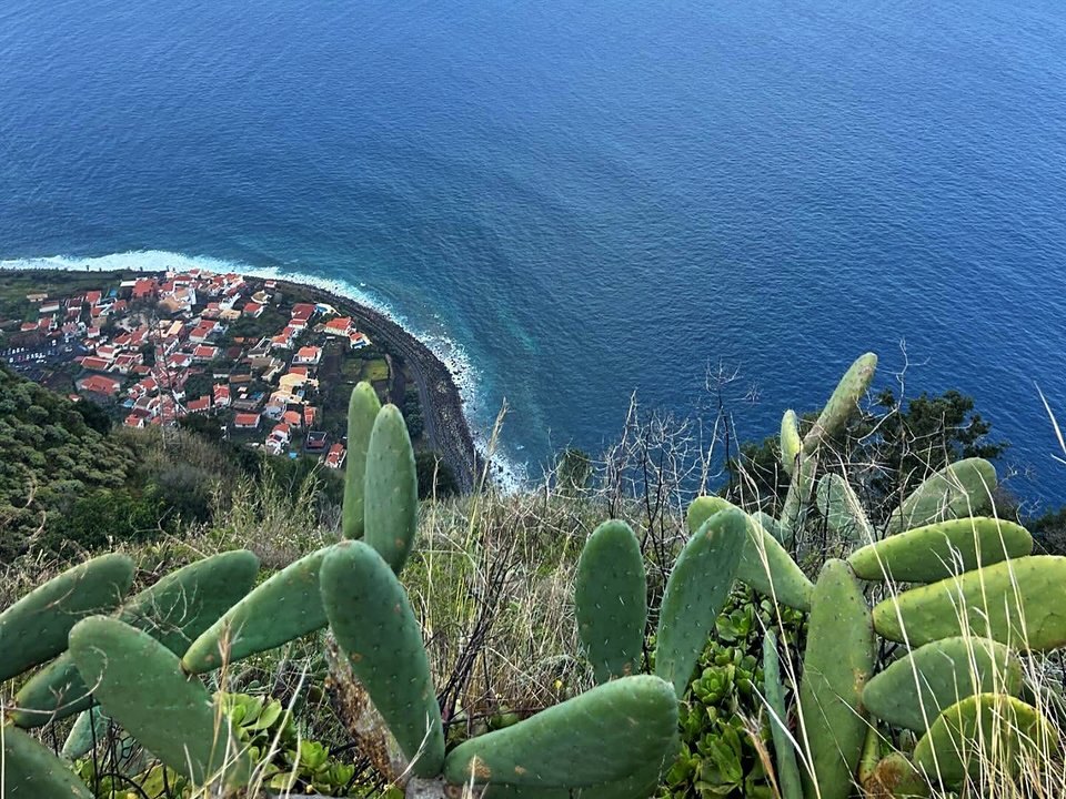
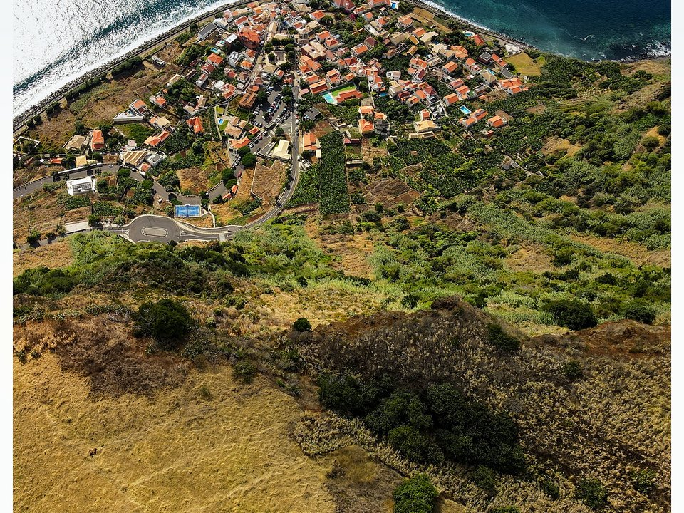
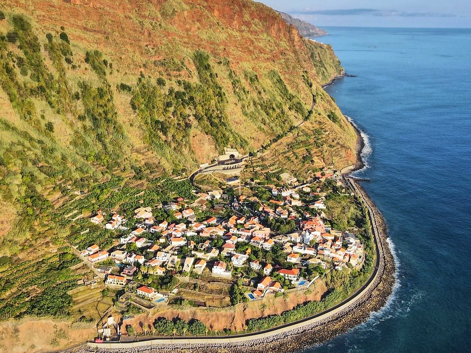
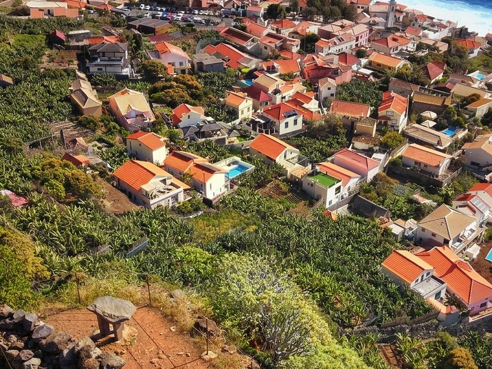
Situated along the sun-drenched southwestern coastline of Calheta, Vereda do Jardim do Mar represents a demanding unpatrolled coastal loop linking Prazeres, the picturesque coastal hamlet of Jardim do Mar, and the historic fishing harbor of Paul do Mar. Traversing traditional cobbled agricultural stairways (calçada de pedra de seixo), raw ocean boulder beaches, and soaring cliffside paths, this route encapsulates the dramatic vertical transition from high rural plateau pastures down to sea level. The trail offers breathtaking views across the open Atlantic Ocean and southwestern headlands. Because it remains an unclassified local trail outside the official IFCN network, walkers must navigate without official trail markers, tidal safety barriers, or regular rockfall clearance.
Route Profile & Terrain Details
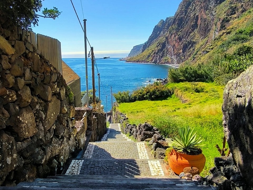
- Surface conditions underfoot: Hikers on Vereda do Jardim do Mar traverse polished river cobblestones, steep drystone steps, and a rough intertidal shoreline strewn with massive basalt boulders.
- Vertical exposure and protection: The steep descent from Prazeres and ascent to Paul do Mar trace cliff margins where handrails are sporadic and natural drops exceed several hundred meters.
- Gradients and elevation profile: The circuit demands extreme physical exertion, plunging over 550 vertical meters to sea level before climbing back out of the amphitheater.
- Hydrological conditions and weather exposure: The shoreline connection between Jardim do Mar and Paul do Mar is governed by ocean tides and can become completely impassable during high water or rough swell.
Trailhead Access, Parking & Return Transfer
- Road approach and connectivity: Approaches utilize the VR 1 highway from Funchal transitioning onto the ER 222 corridor toward Prazeres, parking near the village center or church square.
- Trailhead parking availability: Public parking bays around the center of Prazeres offer reliable vehicle parking, while secondary parking exists along the oceanfront esplanade at Jardim do Mar.
- Public transit connections: Bus services operated by SIGA Madeira (West / Northwest) western routes connecting Funchal with Ponta do Pargo provide scheduled links to Prazeres and coastal villages.
- Return logistics and transfer options: Completing the entire walking circuit via the shoreline and ascending PR 19 back to Prazeres closes a natural loop without requiring a vehicle shuttle.
Historic Landscape & Heritage Context
Prior to modern road tunnels chiseled through the mountains in the late twentieth century, the villages of Jardim do Mar and Paul do Mar were entirely isolated between sheer cliffs and crashing waves. Vereda do Jardim do Mar formed the vital lifeline (caminho de ligação) through which coastal residents carried fresh ocean fish up to the agricultural markets of Prazeres in exchange for highland potatoes, firewood, and flour. The meticulous stone paving, built from rounded pebbles hauled up from the beach and set on edge, demonstrates the ingenious drystone engineering developed by Madeiran masons to prevent rainwater erosion. Walking through Jardim do Mar reveals timeless whitewashed cottages, narrow pedestrian alleys, and lush subtropical gardens fed by ancient levada runoffs.
Field Safety & Official PR Alternatives
Completing Vereda do Jardim do Mar safely requires careful timing and appropriate alpine footwear. Crucially, the coastal boulder stretch between Jardim do Mar and Paul do Mar must be undertaken strictly at low tide with calm sea conditions; high Atlantic surf frequently sends powerful breakers crashing against the foot of the cliffs, creating life-threatening entrapment hazards. Always consult local tide tables before departure. Protect against intense solar radiation, bring plenty of water, and carry trekking poles to ease joint strain on the punishing descents. If incoming swells or rising tides block the shoreline, do not attempt to scramble across the rocks; retrace your steps or take a taxi between the coastal villages.
Official classified PR alternatives near Calheta
Hikers seeking certified routes with regular condition surveys and verified trail infrastructure in Calheta can explore these recommended classified alternatives to Vereda do Jardim do Mar:
- PR 19 Caminho Real do Paul do Mar — 1.8 km between Prazeres and Paul do Mar in Calheta (listed open on the 2 October 2026 IFCN table). Offers a historic paved cliff descent with maintained handrails and signed trailheads.
- PR 6 Levada das 25 Fontes — 4.3 km each way (8.6 km there and back) in the Rabaçal basin of Calheta (listed open on the 2 October 2026 IFCN table). Features verified security balustrades, certified waterfalls, and active ranger inspections.
- PR 6.1 Levada do Risco — 3 km each way (6 km there and back) leading to the great cascading falls of Rabaçal (listed open on the 2 October 2026 IFCN table). Delivers a wide, family-friendly gravel footpath with full regional signage.
Other unpatrolled routes surveyed in the municipality of Calheta include Levada Nova da Calheta and Levada dos Zimbreiros, detailed in the unknown trails catalog outside the official classified network. Documentation source for Vereda do Jardim do Mar: Southwestern municipal historical records and coastal walking registers, contrasted with IFCN Percursos pedestres classificados (updated 2 October 2026, read 12 October 2026).
Specifications & facts
- Type
- Levada
- Area
- Calheta
- Difficulty
- Demanding
- Distance
- 8.5 km
- Time
- 3 h 15 min
- Elevation
- 550 m descent and ascent
- Start
- Prazeres
- Finish
- Paul do Mar
Post-Hike Refuel & Dining Radar
Authentic Post-Hike Hospitality
Trailhead & Village Refuel Radar
Nothing defines Madeiran hiking culture more authentically than gathering at a rustic mountain bar or fisherman's tasca right after the trek. Verified local venues within minutes of the finish:
Bar O Farol
Field photographs along the channel