PR 8 · PR route
PR 8 Vereda da Ponta de São Lourenço
Distance
4 km each way (8 km there and back)
2 h 30 min – 3 h 00 min
IFCN Fee
€4.50
Return to Car
Returns to starting car park
Area / Difficulty
Ponta de São Lourenço · Moderate
Status note. IFCN, 25 October 2026: Open, 4 km each way. Footbridge replacement works underway (360-day project from 30 Sept 2026); an active, signposted 30-second dry-stream bypass is in place just past the start boardwalk. The full route to Cais do Sardinha is open in both directions. Updated 25 Oct 2026.
PR 8 Vereda da Ponta de São Lourenço is open from Baía d'Abra to Cais do Sardinha (4 km each way) with a 30-second boardwalk detour around active footbridge replacement works.
Notices still inside their window
Checking notices.
Start Car Park
Baía d'Abra
Baía d'Abra → Cais do Sardinha
⇄ Open Both WaysClosure & Congestion Mitigation
Twin-Trail & Plan-B Engine
If parking is saturated or weather conditions deteriorate at PR 8 Vereda da Ponta de São Lourenço, these nearby alternative routes share the same terrain character and offer verified open conditions.
Vereda do Larano
Ocean cliff face trail with dramatic volcanic stratigraphy and sea views
Pico do Facho
Eastern coastal ridge with expansive views over Machico and Caniçal
Field Logistics Intelligence
Return-to-Car & Linear Loop Solver
Self-contained vehicle loop: this route safely returns directly to your starting parking bay at Baía d'Abra.
Self-Contained Vehicle Return
This trail is an out-and-back or circular loop that terminates at the same parking area where you started (Baía d'Abra). No taxi, public bus transfer, or multi-car shuttle required.
Optional public transit arrival: 113 ().
Coordination & Taxi-Split Action
Send this verified return plan to your group via WhatsApp or SMS.
Field Hazard & Body Impact Intelligence
Reality Matrix: Tunnels, Vertigo & Knee Strain
Beyond generic difficulty ratings: quantitative engineering metrics on pitch-black irrigation tunnels, abyss exposure tiers, and knee-joint impact on steep Caminho Real cobblestones.
0 m
Open air route
Tunnel-free routing with natural daylight throughout.
Tier 2 · Moderate Exposure
Exposed volcanic peninsula with sheer 100m sea cliffs safeguarded by steel wire cables.
Not recommended for hikers with severe acrophobia or vertigo sensitivity.
Level 2 · Moderate Steps
Undulating dirt trail with wooden stairs; no long basalt cobble descents.
Flat levada bed protects knees and hip joints from cumulative descent trauma.
Atlantic Microclimate Intelligence
Live Island Clock & Microclimate Advisor
Simulate your planned departure hour to beat the cloud inversion ceiling, trade-wind fogs, and trailhead parking saturation.
Prime trail window: 08:00 - 10:30
Trailhead Parking
Ample · Laybys empty
Cloud Ceiling Risk
Clear skies · Above cloud sea
Trail Congestion
Very Light · Trail to yourself
Sun & Wind Load
Cool & Crisp · Light windbreaker
IPMA UV Index 9–11 Radiation Advisory
IPMA UV Index 9–11 Advisory: High-altitude ridge and exposed peninsula terrain receive extreme UV radiation (Index 9–11), even through thin cloud cover and summit mist. High-SPF sun protection, UV-blocking eyewear, and headwear are required.
Field advisory: Coastal maritime microclimate; protect against morning sun and changing sea breezes.
2026 IFCN & SIMplifica Tariff Engine
Permit, Parking & Transfer Cost Estimator
Calculate your exact party outlay under the 2026 SIMplifica regulatory regime, including legal resident and child exemptions, parking caps, and return transit.
Adult Hikers (> 12 years)
Standard permit €4.50
Children (≤ 12 years)
100% Legally Exempt (€0.00)
Madeira / PT Residents
100% Resident Exemption (€0.00)
Forest Police (Corpo de Polícia Florestal) inspect digital tickets at trailheads. Fines of €50–€500 apply for unregistered hikers.
Offline Survival Pocket Card: PR 8 Vereda da Ponta de São Lourenço
Essential route facts and offline navigation notes for remote terrain with zero cellular signal
Start Trailhead GPS
32.7445° N, 16.7050° W
Baía d'Abra · 0 m elevation
GPS: 32.7445, -16.705
Finish / Terminus GPS
32.7415° N, 16.6780° W
Cais do Sardinha, then back · 160 m elevation
GPS: 32.7415, -16.678
Distance
4 km each way (8 km there and back)
Estimated Time
2 h 30 min – 3 h 00 min
Elevation Profile
+420 m / -420 m (undulating coastal cliff, 0 m – 160 m)
Difficulty Grade
Moderate
Emergency SOS & Civil Protection
112 — European Emergency SOS (Universal)
Civil Protection (Proteção Civil): +351 291 700 112
IFCN Forest Police (Polícia Florestal): +351 291 102 700
VHF Marine Ch. 16 / Mountain SAR
Rule:Cardinal Survival Rule: Stay strictly on the levada path. Never descend into stream gorges or waterfalls. If cloud ceiling descends, halt and wait in place.
Car park check
Pick the car park where the car stays. These lines are the table checked on 25 Oct 2026.
Both ways · 4 km each way
Baía d'Abra → Cais do Sardinha
You can walk this section and come back to Baía d'Abra.
Fee figure on the checked table: €4.50.
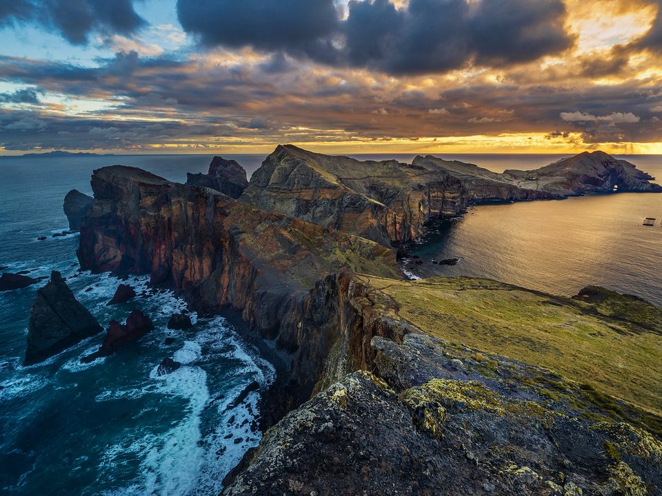
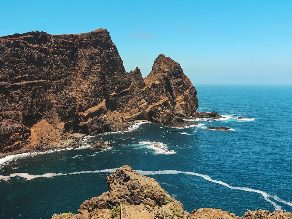
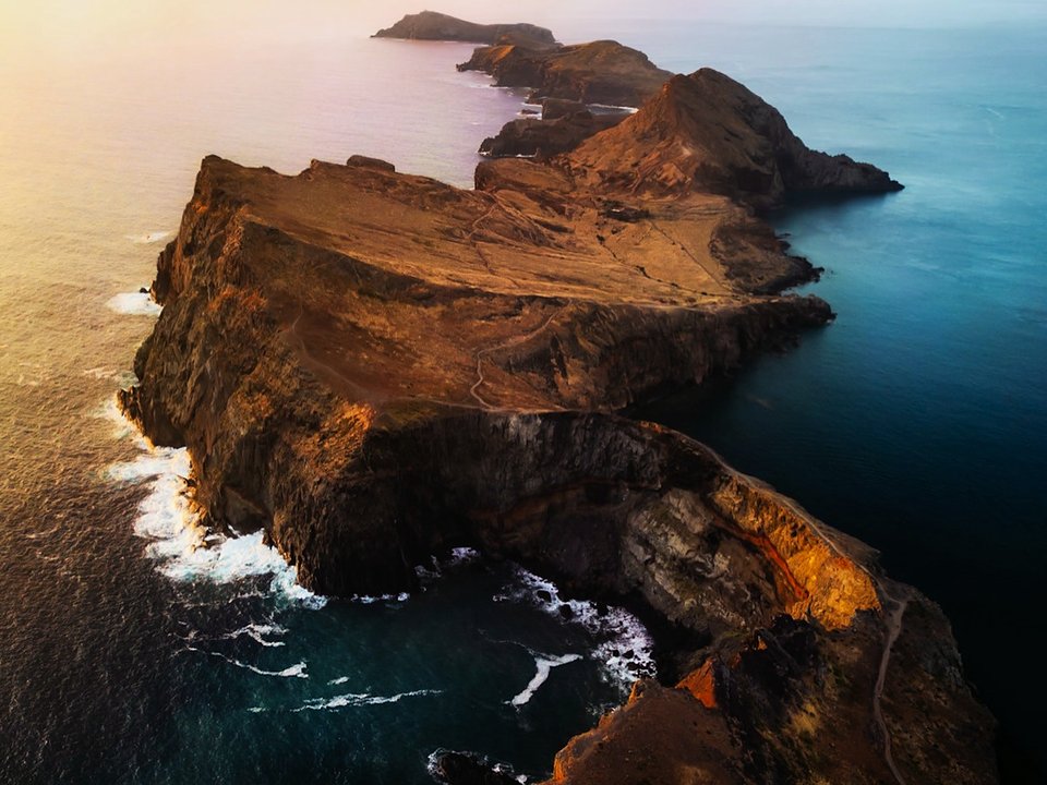
PR 8 Vereda da Ponta de São Lourenço is on the IFCN classified-trail table verified on 25 October 2026. The official distance is 4 km each way (8 km there and back). The places named there are Baía d'Abra and Cais do Sardinha. The status on that table is: open. Route Summary: 4 km each way (8 km there and back) · 2 h 30 min – 3 h 00 min · +420 m / -420 m (undulating coastal cliff, 0 m – 160 m) · Moderate · Out-and-back returns to car. Stretching across the narrow, windswept volcanic peninsula east of Caniçal, PR 8 is the flagship coastal hike on Madeira and the second most searched route on the island after Pico Ruivo. As detailed in PR 8 Ponta de São Lourenço footbridge works and active detour, a 360-day footbridge replacement project began on 30 September 2026 (€487,000); a signposted 30-second dry-stream detour bypasses the boardwalk works, and the full 4 km route to Cais do Sardinha is completely open in both directions.
Out-and-back logistics, parking at Baía d'Abra, and bus 113
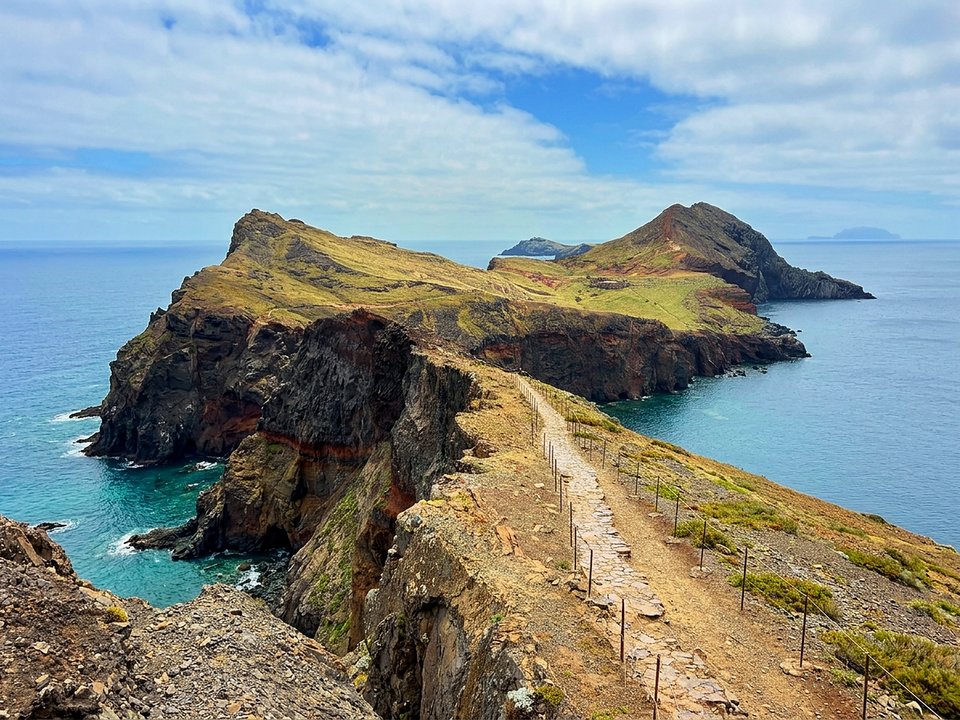
PR 8 starts at the road-end turnaround of Baía d'Abra (at the eastern end of the ER 109 past Caniçal) and runs 4 km out along the spine of the headland to the Cais do Sardinha pier and Casa do Sardinha oasis, returning 4 km along the same path to Baía d'Abra:
- Direct return to your car: Because Baía d'Abra is a dead-end peninsula car park, every hiker walking out-and-back returns directly to their starting vehicle after the 8 km round trip.
- Public bus 113 from Funchal and Machico: Unlike high-mountain trailheads, PR 8 is served directly by public bus line 113, which terminates right at the Baía d'Abra roundabout at the trailhead gate.
- Parking capacity: The roundabout and approaching roadside bays on the ER 109 fill quickly between 08:00 and 11:00. Park only in legal roadside spaces and never block the central turnaround circle used by bus 113 and emergency vehicles.
- Optional boat return: During calm sea conditions, seasonal water taxis operate between the Cais do Sardinha pier and the Quinta do Lorde marina (walkable or a short hop back to Baía d'Abra), but always plan and carry water for the full 8 km walk in case swell closes the pier.
Terrain, sun exposure, and Atlantic crosswinds
Ponta de São Lourenço is a semi-arid nature reserve whose climate and terrain contrast sharply with Madeira's shaded levadas:
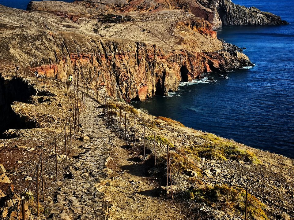
- Constant ups and downs: Despite a modest maximum elevation, the 8 km round trip is a coastal rollercoaster of stone steps, wooden boardwalks, eroded tuff slopes, and narrow cliff bridges with steep climbs on both the outward and return legs.
- Zero shade: Apart from the cluster of palm trees at Casa do Sardinha near the turnaround, there is no shade anywhere on PR 8. Carry at least 1.5 litres of water per person, high-SPF sunscreen, sunglasses, and a secure sunhat.
- Strong trade winds: Northeast gusts sweep across the exposed saddles where cliffs drop into the Atlantic on both sides. Hold the post-and-cable railings on narrow sections and stay strictly within the roped path corridor to protect fragile coastal flora and nesting seabirds.
Before you go
With zero natural tree shade between the Baía d'Abra car park and Cais do Sardinha, carry extra drinking water, sun protection, and a windproof layer—and confirm sea state in advance if you hope to return by boat pier. The IFCN fee FAQ lists €4.50 per person for one classified route other than PR 1. Residents of the region, children aged 12 or under, and covered disability cases do not pay the fee and still need a reservation; see PR trail fees and reservation rules on Madeira. This site does not publish a live forecast. Source: Percursos pedestres classificados, table verified 25 October 2026. The fee figures are from the IFCN fee FAQ.
Specifications & facts
- Type
- PR route
- Area
- Ponta de São Lourenço
- Difficulty
- Moderate
- Distance
- 4 km each way (8 km there and back)
- Time
- 2 h 30 min – 3 h 00 min
- Elevation
- +420 m / -420 m (undulating coastal cliff, 0 m – 160 m)
- Start
- Baía d'Abra
- Finish
- Cais do Sardinha, then back
- Return
- Returns to starting car park
- Fee
- €4.50
Authentic Post-Hike Hospitality
Trailhead & Village Refuel Radar
Nothing defines Madeiran hiking culture more authentically than gathering at a rustic mountain bar or fisherman's tasca right after the trek. Verified local venues within minutes of the finish:
Bar Amarelo
Field photographs along the channel