LOCAL · CURRAL DAS FREIRAS · Fajã dos Cardos → Lombo do Urzal
UNKNOWN TRAIL · BOCA DAS TORRINHAS · LEVADA · FREE
Boca das Torrinhas
13.0 KM · 5H00–5H30 · HARD · FAJÃ DOS CARDOS TO LOMBO DO URZAL
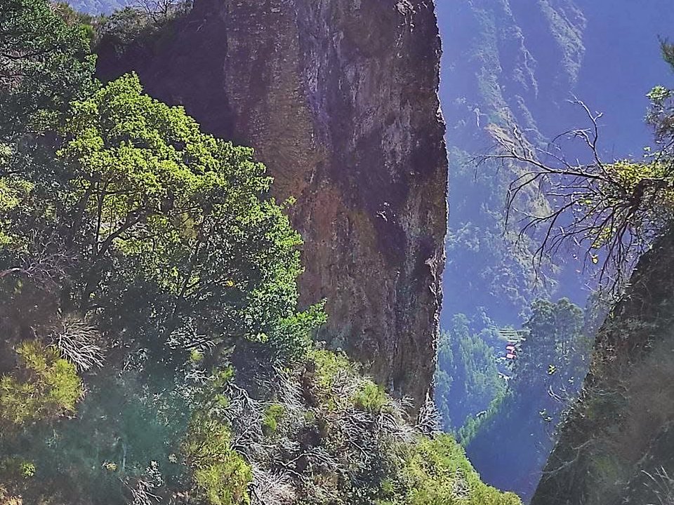
Fajã dos Cardos
Trailhead Access · Free Roadside Parking
Sabores do Curral
Panoramic caldera viewpoint terrace
Lombo do Urzal
Trail End
Exit Terminus (Lombo do Urzal)
13.0 KM Total Route
[X]Unmaintained Ridge Path
Unpatrolled Crest · Steep Cliff Drop-offs
DEPART BEFORE 06:30 AT FAJÃ DOS CARDOS — CLOUD CEILING BUILDS BY 10:30
1 BASALT TUNNEL (LONGEST 200M) — DEDICATED HEADLAMP REQUIRED & WATERPROOF FOOTWEAR
POINT-TO-POINT FINISH AT LOMBO DO URZAL: RETURN TAXI EST. €25.00 - 35.00 OR PRE-ARRANGE SHUTTLE
Distance
13.0 km
5 h 00 min · 950 m ascent / 1,400 m descent
IFCN Fee
Free
Return to Car
—
Area / Difficulty
Curral das Freiras · Difficult
Status note. 12 October 2026: 13.0 km, hard alpine pass, 5 h 00 min. Not an IFCN figure. IFCN does not maintain this walk. Updated 12 Oct 2026.
Boca das Torrinhas is 13.0 km, hard alpine pass. Not on the IFCN list.
Interactive Field Calculators & Logistics Tools (Shuttle, Cost, Microclimate & Offline Card)
Closure & Congestion Mitigation
Twin-Trail & Plan-B Engine
Because parts of Boca das Torrinhas are currently restricted or closed under IFCN decree, hike these verified open twin routes with matching terrain DNA, elevation drama, and scenery.
PR 1.2 Vereda do Pico Ruivo
Reliable alpine crest alternative with verified open status
Pico Grande
Rugged volcanic summit alternative in the central massif
Field Logistics Intelligence
Return-to-Car & Linear Loop Solver
Point-to-point routes end away from your vehicle. Review verified 2026 public bus lines, taxi fares, midpoint key swaps, or connecting footpaths to return to Fajã dos Cardos (Curral das Freiras).
Line: SIGA Regional Service
SIGA Madeira (West / Northwest) regional network
Coordination & Taxi-Split Action
Send this verified return plan to your group via WhatsApp or SMS.
Field Hazard & Body Impact Intelligence
Reality Matrix: Tunnels, Vertigo & Knee Strain
Beyond generic difficulty ratings: quantitative engineering metrics on pitch-black irrigation tunnels, abyss exposure tiers, and knee-joint impact on steep Caminho Real cobblestones.
200 m
Longest underground passage
Hands-free headlamp is required: smartphone flashlights leave only one hand free for wet 45 cm canal ledges and risk dropping phones into the channel.
Tier 2 · Moderate Exposure
Protected path with modest exposure to hillside slopes.
Not recommended for hikers with severe acrophobia or vertigo sensitivity.
Level 2+ · Strenuous Stone Steps
Steep elevation change and stone steps place continuous strain on knees.
Trekking poles strongly recommended to absorb eccentric downhill shock on rounded stones.
Atlantic Microclimate Intelligence
Live Island Clock & Microclimate Advisor
Simulate your planned departure hour to beat the cloud inversion ceiling, trade-wind fogs, and trailhead parking saturation.
Prime trail window: 06:30 - 08:30
Trailhead Parking
Ample · Laybys empty
Cloud Ceiling Risk
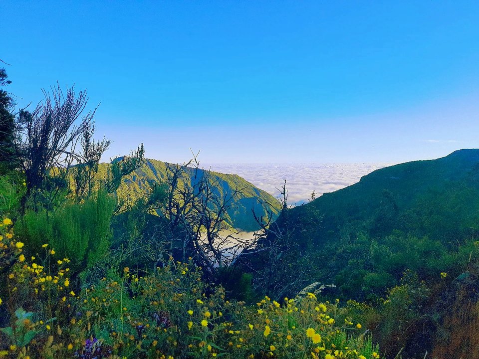
Clear skies · Above cloud sea
Trail Congestion
Very Light · Trail to yourself
Sun & Wind Load
Cool & Crisp · Light windbreaker
Field advisory: Early departure strongly advised to beat cloud ceiling condensation and trade wind turbulence.
2026 IFCN & SIMplifica Tariff Engine
Permit, Parking & Transfer Cost Estimator
Calculate your exact party outlay under the 2026 SIMplifica regulatory regime, including legal resident and child exemptions, parking caps, and return transit.
Adult Hikers (> 12 years)
Standard permit €0.00
Children (≤ 12 years)
100% Legally Exempt (€0.00)
Madeira / PT Residents
100% Resident Exemption (€0.00)
Forest Police (Corpo de Polícia Florestal) inspect digital tickets at trailheads. Fines of €50–€500 apply for unregistered hikers.
Offline Survival Pocket Card: Boca das Torrinhas
Essential route facts and offline navigation notes for remote terrain with zero cellular signal
Start Trailhead GPS
32.7389° N, 16.9778° W
Fajã dos Cardos (Curral das Freiras) · 950 m elevation
GPS: 32.7389, -16.9778
Finish / Terminus GPS
32.7933° N, 16.9817° W
Lombo do Urzal (Boaventura) · 1400 m elevation
GPS: 32.7933, -16.9817
Distance
13.0 km
Estimated Time
5 h 00 min
Elevation Profile
950 m ascent / 1,400 m descent
Difficulty Grade
Hard
Emergency SOS & Civil Protection
112 — European Emergency SOS (Universal)
Civil Protection (Proteção Civil): +351 291 700 112
IFCN Forest Police (Polícia Florestal): +351 291 102 700
VHF Marine Ch. 16 / Mountain SAR
Rule:Cardinal Survival Rule: Stay strictly on the levada path. Never descend into stream gorges or waterfalls. If cloud ceiling descends, halt and wait in place.
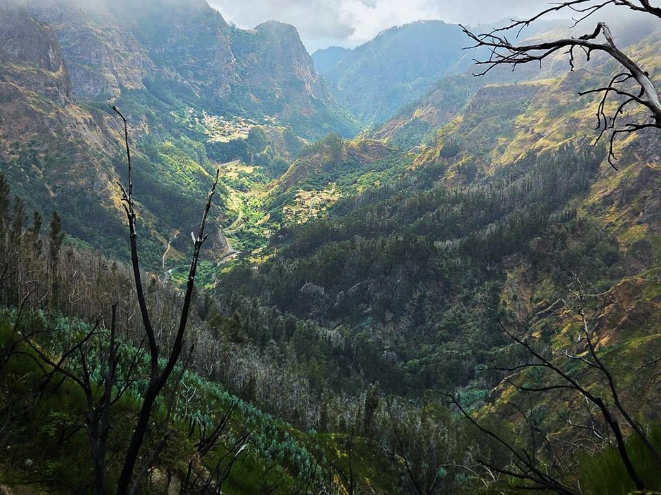
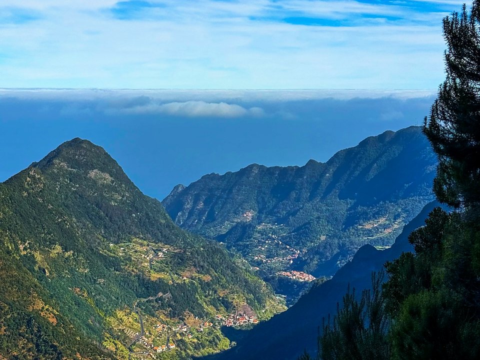
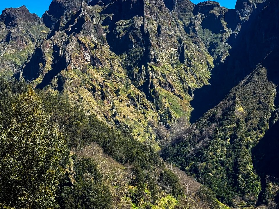
Connecting the deep volcanic caldera of Curral das Freiras with the wild northern river valleys of Boaventura, Boca das Torrinhas represents an epic unpatrolled alpine mountain pass crossing the central cordillera of Madeira. Soaring to a lofty saddle elevation of 1,416 meters between the iconic peaks of Pico Ruivo and Pico das Torrinhas, this demanding mountain crossing offers one of the most rugged and visually awe-inspiring journeys on the island. Walkers climb through steep terraced valleys, traverse high alpine scrub, and plunge down through untouched cloud forests. Because this trail is not an officially maintained Percurso Recomendado, it lacks safety cables, ranger supervision, and post-storm clearance.
Route Profile & Terrain Details
- Surface conditions underfoot: Hikers on Boca das Torrinhas climb steep basalt stairways, eroded volcanic scree, exposed bedrock, and slick forest trails carpeted with wet moss and leaves.
- Vertical exposure and protection: The high alpine col and upper ridges present dizzying vertical drops into Curral das Freiras and Boaventura with zero safety barriers or safety cables.
- Gradients and elevation profile: The route demands severe physical endurance, tackling nearly 1,000 meters of relentless ascent followed by 1,400 meters of continuous knee-straining descent into the north.
- Hydrological conditions and weather exposure: Mountain passes in the central massif are vulnerable to sudden freezing cloudbursts, severe temperature drops, and blinding cloud whiteouts.
Trailhead Access, Parking & Return Transfer
- Road approach and connectivity: Approaches to the southern start utilize the ER 107 road into Curral das Freiras, continuing to the trailhead at Fajã dos Cardos; northern access terminates at Lombo do Urzal in Boaventura.
- Trailhead parking availability: Limited roadside parking bays exist at Fajã dos Cardos and Lombo do Urzal, where parked cars must not block bus turning circles or rural driveways.
- Public transit connections: Horários do Funchal (SIGA) urban and mountain bus networks serve Curral das Freiras from Funchal, while SIGA Madeira (West / Northwest) northern coastal feeder routes connect Boaventura on the north coast.
- Return logistics and transfer options: Because this is a point-to-point trans-island traverse, hikers must arrange a taxi transfer or coordinated two-car shuttle between Curral das Freiras and Boaventura.
Historic Landscape & Heritage Context
For centuries prior to vehicular tunnels and modern communications, Boca das Torrinhas served as the primary overland artery connecting northern and southern Madeira across the central peaks. Known historically as a vital mountain garganta (throat), the pass was traversed by mountain traders carrying salted fish, northern wicker, wine, and livestock between isolated parish communities. Religious pilgrims and traveling doctors walked these switchbacks in all seasons. The dramatic jagged pinnacles flanking the saddle (Torrinhas, meaning little towers) gave the pass its name. The trail preserves exquisite drystone calçada and retaining walls constructed by ancestral islanders who braved alpine blizzards to maintain connectivity.
Field Safety & Official PR Alternatives
Tackling Boca das Torrinhas requires advanced mountain fitness, alpine experience, and complete self-sufficiency. The physical demands of the unrelenting ascent and knee-pounding descent require proper trekking poles and rigid, waterproof hiking boots. Weather conditions at 1,400 meters can deteriorate in minutes; hikers must pack warm thermal layers, windproof outer shells, emergency survival bags, and a navigation app with downloaded offline GPS maps. Do not embark on this traverse if cloud ceilings are low, rain is forecast, or high winds are predicted across the peaks. Ensure someone knows your route and expected arrival time before entering the high massif.
Official classified PR alternatives near Curral das Freiras
Hikers seeking certified mountain routes with regular forestry inspections and clear directional signage around Curral das Freiras can choose these recommended classified alternatives to Boca das Torrinhas:
- PR 2 Vereda do Urzal — 10.3 km connecting Curral das Freiras with Boaventura (listed open on the 2 October 2026 IFCN table). Offers a certified trans-massif crossing with formal forestry clearance and established safety standards.
- PR 1.3 Vereda da Encumeada — 11.2 km along the central alpine ridge (open between Pico Ruivo and Boca das Torrinhas on the 2 October 2026 IFCN table). Delivers an exceptional alpine crest route with verified open sections.
- PR 12 Caminho Real da Encumeada — 12.5 km crossing from Boca da Corrida to Encumeada (listed open on the 2 October 2026 IFCN table). Features maintained historical paths with panoramic valley viewpoints.
Other unpatrolled mountain routes surveyed across the central amphitheater include Vereda da Eira do Mourão and Pico Grande from Boca da Corrida, cataloged on the unknown trails guide outside the classified network. Documentation source for Boca das Torrinhas: Central mountain surveying records and historical Madeira transport archives, contrasted with IFCN Percursos pedestres classificados (updated 2 October 2026, read 12 October 2026).
Specifications & facts
- Type
- Levada
- Area
- Curral das Freiras
- Difficulty
- Hard
- Distance
- 13.0 km
- Time
- 5 h 00 min
- Elevation
- 950 m ascent / 1,400 m descent
- Start
- Fajã dos Cardos (Curral das Freiras)
- Finish
- Lombo do Urzal (Boaventura)
Post-Hike Refuel & Dining Radar
Authentic Post-Hike Hospitality
Trailhead & Village Refuel Radar
Nothing defines Madeiran hiking culture more authentically than gathering at a rustic mountain bar or fisherman's tasca right after the trek. Verified local venues within minutes of the finish:
Sabores do Curral
Field photographs along the channel