LOCAL · RIBEIRA BRAVA · Eira do Mourão → Fajã
UNKNOWN TRAIL · VEREDA DA EIRA DO MOURÃO · LEVADA · FREE
Vereda da Eira do Mourão
1.4 KM · 0H50 · MODERATE · EIRA DO MOURÃO TO FAJÃ
Eira do Mourão
Trailhead Access · Free Roadside Parking
Tasca da Serra
Friendly village café near trail access road
Fajã
Trail End
Exit Terminus (Fajã)
1.4 KM Total Route
[X]Unmaintained Ridge Path
Unpatrolled Crest · Steep Cliff Drop-offs
OPTIMAL WINDOW: 08:00 - 10:30 FROM EIRA DO MOURÃO — SHADED LAURISSILVA CANOPY; EXPECT DAMP LEDGES
HIGH VERTIGO EXPOSURE: NARROW CLIFF LEDGES WITH DROP-OFFS — RIGID SOLED BOOTS & SURE FOOTING ESSENTIAL
POINT-TO-POINT FINISH AT FAJÃ: RETURN TAXI EST. €25.00 - 35.00 OR PRE-ARRANGE SHUTTLE
Distance
1.4 km
50 min · 33 m ascent, 331 m descent
IFCN Fee
Free
Return to Car
—
Area / Difficulty
Ribeira Brava · Moderate
Status note. 12 October 2026: 1.4 km, moderate, 50 min. Not an IFCN figure. IFCN does not maintain this walk. Updated 12 Oct 2026.
Vereda da Eira do Mourão is 1.4 km, moderate. Not on the IFCN list.
Interactive Field Calculators & Logistics Tools (Shuttle, Cost, Microclimate & Offline Card)
Closure & Congestion Mitigation
Twin-Trail & Plan-B Engine
Because parts of Vereda da Eira do Mourão are currently restricted or closed under IFCN decree, hike these verified open twin routes with matching terrain DNA, elevation drama, and scenery.
PR 8 Ponta de São Lourenço
Iconic open coastal trail with ocean views
PR 11 Vereda dos Balcões
Accessible viewpoint walk through native forest
Field Logistics Intelligence
Return-to-Car & Linear Loop Solver
Point-to-point routes end away from your vehicle. Review verified 2026 public bus lines, taxi fares, midpoint key swaps, or connecting footpaths to return to Eira do Mourão.
Line: SIGA Regional Service
SIGA Madeira (West / Northwest) regional network
Coordination & Taxi-Split Action
Send this verified return plan to your group via WhatsApp or SMS.
Field Hazard & Body Impact Intelligence
Reality Matrix: Tunnels, Vertigo & Knee Strain
Beyond generic difficulty ratings: quantitative engineering metrics on pitch-black irrigation tunnels, abyss exposure tiers, and knee-joint impact on steep Caminho Real cobblestones.
0 m
Open air route
Tunnel-free routing with natural daylight throughout.
Tier 2+ · High Exposure
Exposed cliff edges and natural drop-offs along the trail margin.
Not recommended for hikers with severe acrophobia or vertigo sensitivity.
Level 2+ · Strenuous Stone Steps
Steep elevation change and stone steps place continuous strain on knees.
Trekking poles strongly recommended to absorb eccentric downhill shock on rounded stones.
Atlantic Microclimate Intelligence
Live Island Clock & Microclimate Advisor
Simulate your planned departure hour to beat the cloud inversion ceiling, trade-wind fogs, and trailhead parking saturation.
Prime trail window: 08:00 - 10:30
Trailhead Parking
Ample · Laybys empty
Cloud Ceiling Risk
Clear skies · Above cloud sea
Trail Congestion
Very Light · Trail to yourself
Sun & Wind Load
Cool & Crisp · Light windbreaker
Field advisory: Coastal maritime microclimate; protect against morning sun and changing sea breezes.
2026 IFCN & SIMplifica Tariff Engine
Permit, Parking & Transfer Cost Estimator
Calculate your exact party outlay under the 2026 SIMplifica regulatory regime, including legal resident and child exemptions, parking caps, and return transit.
Adult Hikers (> 12 years)
Standard permit €0.00
Children (≤ 12 years)
100% Legally Exempt (€0.00)
Madeira / PT Residents
100% Resident Exemption (€0.00)
Forest Police (Corpo de Polícia Florestal) inspect digital tickets at trailheads. Fines of €50–€500 apply for unregistered hikers.
Offline Survival Pocket Card: Vereda da Eira do Mourão
Essential route facts and offline navigation notes for remote terrain with zero cellular signal
Start Trailhead GPS
32.6847° N, 17.0167° W
Eira do Mourão · 33 m elevation
GPS: 32.6847, -17.0167
Finish / Terminus GPS
32.6719° N, 17.0647° W
Fajã (Ribeira Brava) · 331 m elevation
GPS: 32.6719, -17.0647
Distance
1.4 km
Estimated Time
50 min
Elevation Profile
33 m ascent, 331 m descent
Difficulty Grade
Moderate
Emergency SOS & Civil Protection
112 — European Emergency SOS (Universal)
Civil Protection (Proteção Civil): +351 291 700 112
IFCN Forest Police (Polícia Florestal): +351 291 102 700
VHF Marine Ch. 16 / Mountain SAR
Rule:Cardinal Survival Rule: Stay strictly on the levada path. Never descend into stream gorges or waterfalls. If cloud ceiling descends, halt and wait in place.
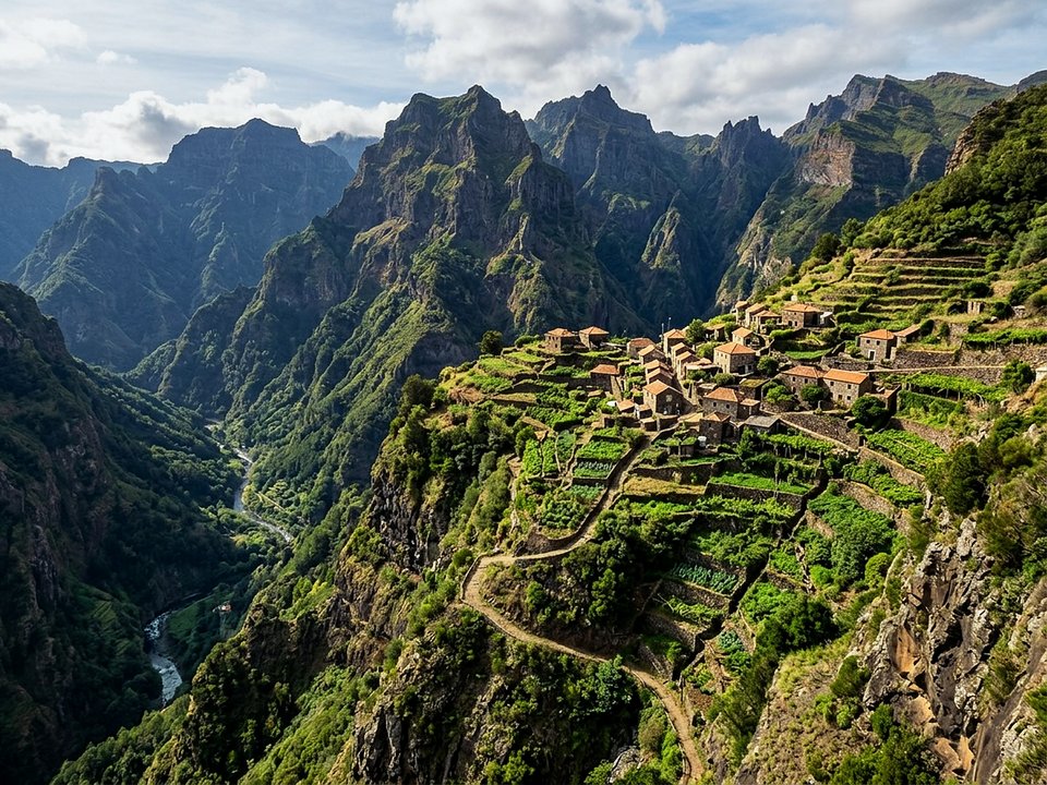
Carved into the hillsides of Ribeira Brava, Vereda da Eira do Mourão constitutes a rustic stone-paved footpath extending between Eira do Mourão and Fajã (Ribeira Brava). Surrounded by dramatic mountain amphitheaters and rich flora, the walkway immerses explorers in serene natural landscapes shaped by centuries of cultivation. Hiking this alignment requires heightened vigilance, as the corridor is unmanaged by IFCN staff and receives no certified safety checks or hazard signposts.
Route Profile & Terrain Details
- Surface conditions underfoot: Footing along Vereda da Eira do Mourão relies on ancestral drystone paving, stepped bedrock transitions, and compacted loam.
- Vertical exposure and protection: Open cliff edges and steep terrace walls flank the path without protective handrails, demanding caution near the drop-off.
- Gradients and elevation profile: Vertical relief is demanding, alternating between steep stepped staircases, brisk switchbacks, and undulating ridge crests.
- Hydrological conditions and weather exposure: Weather conditions shift swiftly between bright sunshine and dense mountain drizzle, with unbridged runoff channels wetting the trail.
Trailhead Access, Parking & Return Transfer
- Road approach and connectivity: Travelers driving to Vereda da Eira do Mourão navigate the VR 1 highway, ER 104 into Serra de Água, and ER 228 over Encumeada, transitioning from major regional arteries to steep rural lanes.
- Trailhead parking availability: Parking availability relies on small roadside bays along the approach lane; preserve full road clearance for municipal service trucks.
- Public transit connections: Hikers using public transport can utilize SIGA Madeira (West / Northwest) central corridor bus connections, though return departures during weekends and late afternoons are infrequent.
- Return logistics and transfer options: Returning to the vehicle at Eira do Mourão requires either turning back along the trail or hiring a local taxi transfer from the terminus at Fajã (Ribeira Brava).
Historic Landscape & Heritage Context
Established during the early settlement of Madeira, Vereda da Eira do Mourão functioned as a traditional caminho real linking hillside hamlets with coastal landings and upland pastures in Ribeira Brava. Traditional construction techniques incorporated pitched stone paving and rock-hewn steps that allowed cattle, pack mules, and travelers to ascend steep amphitheaters safely without slipping. Retracing these historic stone steps connects visitors to the daily rhythms of old Madeira, when footpaths were the only lifeline between mountain homes and coastal harbors.
Field Safety & Official PR Alternatives
Proceeding along Vereda da Eira do Mourão demands heightened awareness, as steep drops and slippery surfaces in Ribeira Brava lack official hazard signage. Hikers should wear sturdy mountain shoes with ankle support to navigate irregular rock-hewn steps safely. Pack high-visibility rain gear, downloaded topographic maps, sufficient trail snacks, and a portable USB battery pack. Never attempt to bypass damaged masonry or landslips along exposed precipices; turn around calmly and exit via the original approach route.
Official classified PR alternatives near Ribeira Brava
For walkers who value verified infrastructure and scheduled forestry maintenance near Ribeira Brava, can rely on these officially maintained PR routes instead of Vereda da Eira do Mourão:
- PR 17 Caminho do Pináculo e Folhadal — 15 km table route between Bica da Cana and Encumeada above Ribeira Brava (listed partly open between Bica da Cana, Caramujo, Folhadal, and Encumeada on the 2 October 2026 IFCN table). Offers a certified walking corridor maintained by regional forestry authorities backed by up-to-date condition bulletins from forestry staff.
- PR 1.3 Vereda da Encumeada — 11.2 km table ridge route starting at the Encumeada pass above Ribeira Brava (listed partly open between Boca das Torrinhas and Encumeada on the 2 October 2026 IFCN table). Serves as an officially monitored levada corridor with certified footing offering reliable public transit connections and turnaround points.
Regional footpaths and unmonitored channels in Ribeira Brava include Levada do Lombo do Mauro and Levada Nova, Tabua, preserved on the unknown trails archive without ranger patrols. Baseline reference for Vereda da Eira do Mourão: Regional trail registries and municipal waterworks documentation, contrasted with IFCN Percursos pedestres classificados (updated 2 October 2026, read 12 October 2026).
Specifications & facts
- Type
- Levada
- Area
- Ribeira Brava
- Difficulty
- Moderate
- Distance
- 1.4 km
- Time
- 50 min
- Elevation
- 33 m ascent, 331 m descent
- Start
- Eira do Mourão
- Finish
- Fajã (Ribeira Brava)
Post-Hike Refuel & Dining Radar
Authentic Post-Hike Hospitality
Trailhead & Village Refuel Radar
Nothing defines Madeiran hiking culture more authentically than gathering at a rustic mountain bar or fisherman's tasca right after the trek. Verified local venues within minutes of the finish:
Tasca da Serra
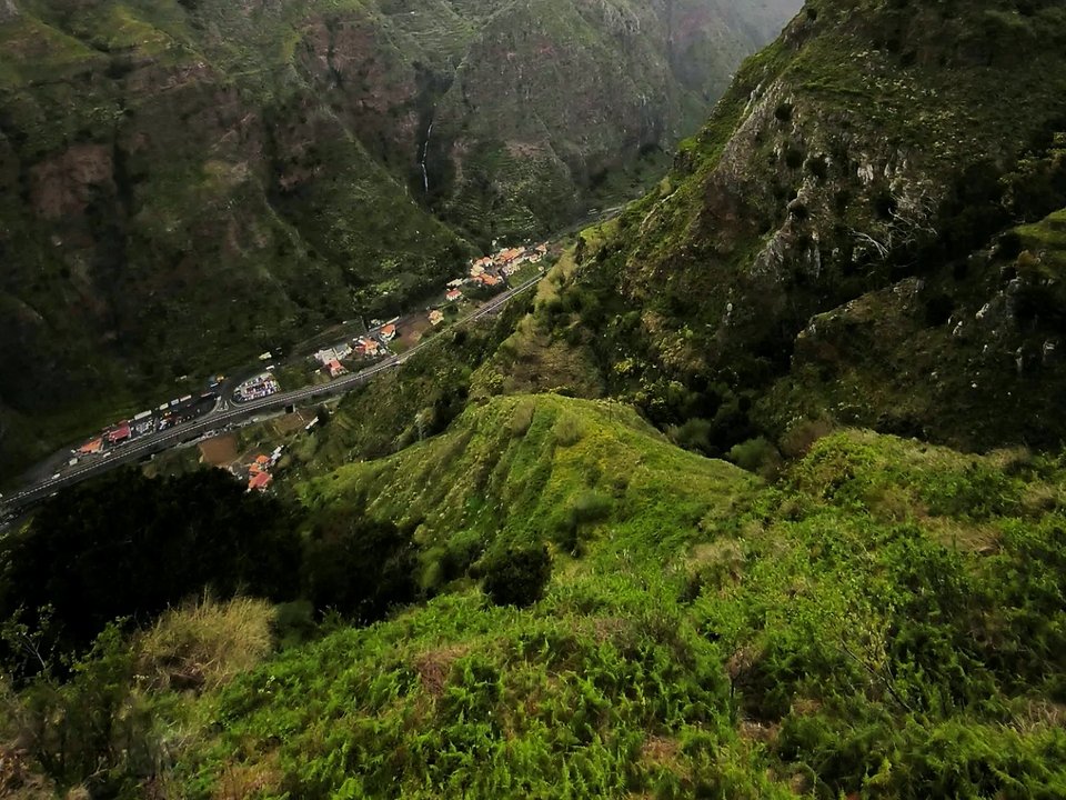
Field photographs along the channel