Local · Levada
CÂMARA DE LOBOS · BOCA DA CORRIDA → CHÃO DOS TERREIROS SUMMIT
Local · CHÃO DOS TERREIROS · 5.5 km · 2 h 00 min · Free
Chão dos Terreiros
MODERATE · CÂMARA DE LOBOS · 300 M ASCENT
Distance
5.5 km
2 h 00 min · 300 m ascent
IFCN Fee
Free
Return to Car
—
Area / Difficulty
Câmara de Lobos · Moderate
Status note. 12 October 2026: 5.5 km, moderate mountain ridge walk, 2 h 00 min. Not an IFCN figure. IFCN does not maintain this walk. Updated 12 Oct 2026.
Boca da Corrida
Start · Câmara de Lobos
5.5 km Channel
2 h 00 min · 300 m ascent
Chão dos Terreiros Summit
Turnaround / Finish · Unpatrolled Local Path · No IFCN Maintenance
START BEFORE 08:30 AM AT BOCA DA CORRIDA FOR CLEAREST VISIBILITY & EASIEST PARKING
POINT-TO-POINT ROUTE (BOCA DA CORRIDA → CHÃO DOS TERREIROS SUMMIT) — PLAN RETURN TAXI OR TURN AROUND AT MIDPOINT
NO IFCN PERMIT FEE REQUIRED ON THIS ROUTE — CHECK LIVE WEATHER & ROCKFALL ALERTS BEFORE DEPARTURE
Chão dos Terreiros is 5.5 km, moderate mountain ridge walk. Not on the IFCN list.
Interactive Field Calculators & Logistics Tools (Shuttle, Cost, Microclimate & Offline Card)
Closure & Congestion Mitigation
Twin-Trail & Plan-B Engine
Because parts of Chão dos Terreiros are currently restricted or closed under IFCN decree, hike these verified open twin routes with matching terrain DNA, elevation drama, and scenery.
PR 1.2 Vereda do Pico Ruivo
Reliable alpine crest alternative with verified open status
Pico Grande
Rugged volcanic summit alternative in the central massif
Field Logistics Intelligence
Return-to-Car & Linear Loop Solver
Point-to-point routes end away from your vehicle. Review verified 2026 public bus lines, taxi fares, midpoint key swaps, or connecting footpaths to return to Boca da Corrida.
Line: SIGA Regional Service
SIGA Madeira (West / Northwest) regional network
Coordination & Taxi-Split Action
Send this verified return plan to your group via WhatsApp or SMS.
Field Hazard & Body Impact Intelligence
Reality Matrix: Tunnels, Vertigo & Knee Strain
Beyond generic difficulty ratings: quantitative engineering metrics on pitch-black irrigation tunnels, abyss exposure tiers, and knee-joint impact on steep Caminho Real cobblestones.
0 m
Open air route
Tunnel-free routing with natural daylight throughout.
Tier 3 · Knife-Edge Abyss
Exposed cliff edges and natural drop-offs along the trail margin.
Not recommended for hikers with severe acrophobia or vertigo sensitivity.
Level 2 · Moderate Steps
Manageable gradient with moderate joint impact.
Trekking poles strongly recommended to absorb eccentric downhill shock on rounded stones.
Atlantic Microclimate Intelligence
Live Island Clock & Microclimate Advisor
Simulate your planned departure hour to beat the cloud inversion ceiling, trade-wind fogs, and trailhead parking saturation.
Prime trail window: 06:30 - 08:30
Trailhead Parking
Ample · Laybys empty
Cloud Ceiling Risk
Clear skies · Above cloud sea
Trail Congestion
Very Light · Trail to yourself
Sun & Wind Load
Cool & Crisp · Light windbreaker
Field advisory: Early departure strongly advised to beat cloud ceiling condensation and trade wind turbulence.
2026 IFCN & SIMplifica Tariff Engine
Permit, Parking & Transfer Cost Estimator
Calculate your exact party outlay under the 2026 SIMplifica regulatory regime, including legal resident and child exemptions, parking caps, and return transit.
Adult Hikers (> 12 years)
Standard permit €0.00
Children (≤ 12 years)
100% Legally Exempt (€0.00)
Madeira / PT Residents
100% Resident Exemption (€0.00)
Forest Police (Corpo de Polícia Florestal) inspect digital tickets at trailheads. Fines of €50–€500 apply for unregistered hikers.
Offline Survival Pocket Card: Chão dos Terreiros
Essential route facts and offline navigation notes for remote terrain with zero cellular signal
Start Trailhead GPS
32.7111° N, 16.9875° W
Boca da Corrida · 300 m elevation
GPS: 32.7111, -16.9875
Finish / Terminus GPS
32.7233° N, 16.9967° W
Chão dos Terreiros Summit · 300 m elevation
GPS: 32.7233, -16.9967
Distance
5.5 km
Estimated Time
2 h 00 min
Elevation Profile
300 m ascent
Difficulty Grade
Moderate
Emergency SOS & Civil Protection
112 — European Emergency SOS (Universal)
Civil Protection (Proteção Civil): +351 291 700 112
IFCN Forest Police (Polícia Florestal): +351 291 102 700
VHF Marine Ch. 16 / Mountain SAR
Rule:Cardinal Survival Rule: Stay strictly on the levada path. Never descend into stream gorges or waterfalls. If cloud ceiling descends, halt and wait in place.
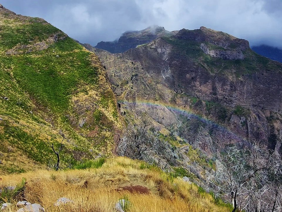
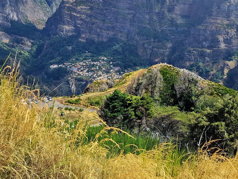
Rising proudly above the mountain divide between Câmara de Lobos and Ribeira Brava, Chão dos Terreiros represents an unpatrolled high-altitude ridge and summit hike starting from the panoramic viewpoint at Boca da Corrida and ascending to the 1,436-meter mountain peak. Offering 360-degree vistas stretching across the deep volcanic bowl of Curral das Freiras, the jagged spires of Pico Grande and Pico Ruivo, and the sparkling southern coastline, this route delivers alpine grandeur without the extreme technical scrambles found on neighboring peaks. Because this trail is an unclassified local route outside the Percursos Recomendados network, it has no official forestry markers, no trail fee requirements, and no maintained infrastructure.
Route Profile & Terrain Details
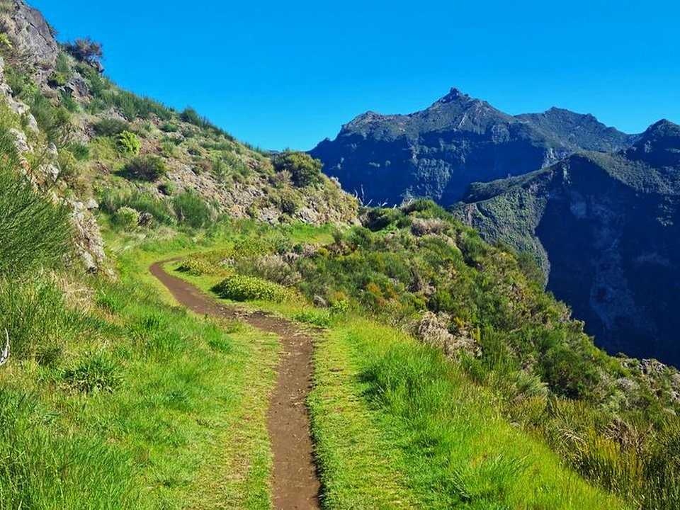
- Surface conditions underfoot: Hikers on Chão dos Terreiros walk along grassy mountain shoulders, dirt tracks, weathered basalt rock ridges, and occasional rocky steps.
- Vertical exposure and protection: The route follows a broad mountain crest with steep side slopes, but generally avoids the sheer, unprotectable vertical abysses of the higher peaks.
- Gradients and elevation profile: The hike gains approximately 300 meters of elevation at a steady, manageable grade over 5.5 kilometers there and back.
- Hydrological conditions and weather exposure: Situated above 1,200 meters, the trail is completely exposed to passing cloud layers, mountain breezes, and swift temperature shifts.
Trailhead Access, Parking & Return Transfer
- Road approach and connectivity: Approaches follow the VR 1 highway to Câmara de Lobos, continuing inland via the ER 229 through Estreito de Câmara de Lobos and Jardim da Serra up to the paved viewpoint lot at Boca da Corrida.
- Trailhead parking availability: The parking area at Miradouro da Boca da Corrida offers paved parking spaces and picnic tables, though spaces fill on clear weekend mornings.
- Public transit connections: Transit via SIGA Madeira (West / Northwest) southern coastal and hillside services reaches Jardim da Serra, after which hikers must take a local taxi to reach the high viewpoint.
- Return logistics and transfer options: Because the route leads to a mountain summit and returns to the same parking area, it forms a straightforward out-and-back hike requiring no vehicle shuttle.
Historic Landscape & Heritage Context
The high ridges surrounding Boca da Corrida have played an enduring role in the pastoral traditions of southern Madeira. For generations, shepherds from Jardim da Serra and Estreito de Câmara de Lobos drove their sheep and goats up onto the grassy plateaus of Chão dos Terreiros during the warm summer months to graze on native mountain tussocks and aromatic herbs. The trail traverses diverse mountain flora, including native broom (Teline maderensis), tree heather (Erica scoparia), and high-altitude ferns. The summit provides an extraordinary vantage point to observe how geological faults and volcanic collapses shaped the dramatic valleys of Curral das Freiras and Serra de Água.
Field Safety & Official PR Alternatives
While Chão dos Terreiros is one of the most accessible 1,400-meter peaks in southern Madeira, mountain safety protocols must always be respected. Even on sunny days on the coast, cloud inversions can rapidly blanket the ridge in dense fog, severely reducing visibility; carrying a GPS-enabled navigation device with an offline trail track is strongly advised. Pack a windproof jacket, warm layers, and plenty of water. Avoid ascending during severe gale warnings or thunderstorms, as the open ridge offers zero lightning shelter. If cloud cover drops and obscures the trail, carefully retrace your route down the grassy shoulder back to Boca da Corrida.
Official classified PR alternatives near Câmara de Lobos
Hikers looking for certified mountain routes with regular forestry oversight and verified infrastructure in Câmara de Lobos can explore these recommended classified alternatives to Chão dos Terreiros:
- PR 12 Caminho Real da Encumeada — 12.5 km departing from the same Boca da Corrida trailhead toward Encumeada (listed open on the 2 October 2026 IFCN table). Offers a certified historical mountain path contouring high above Serra de Água.
- PR 22 Vereda dos Chão dos Louros — 1.9 km near Encumeada pass (listed open on the 2 October 2026 IFCN table). Delivers a short, certified forest circuit under ancient laurel canopies with excellent picnic facilities.
- PR 2 Vereda do Urzal — 10.3 km connecting Curral das Freiras with Boaventura (listed open on the 2 October 2026 IFCN table). Delivers a full trans-island alpine crossing with formal forestry certification.
Other unpatrolled mountain routes surveyed in the upper Câmara de Lobos district include Pico Grande from Boca da Corrida and Levada do Barreiro, cataloged on the unknown trails directory outside the official PR network. Documentation source for Chão dos Terreiros: Regional alpine surveys and Câmara de Lobos municipal hiking registers, contrasted with IFCN Percursos pedestres classificados (updated 2 October 2026, read 12 October 2026).
Specifications & facts
- Type
- Levada
- Area
- Câmara de Lobos
- Difficulty
- Moderate
- Distance
- 5.5 km
- Time
- 2 h 00 min
- Elevation
- 300 m ascent
- Start
- Boca da Corrida
- Finish
- Chão dos Terreiros Summit
Post-Hike Refuel & Dining Radar
Authentic Post-Hike Hospitality
Trailhead & Village Refuel Radar
Nothing defines Madeiran hiking culture more authentically than gathering at a rustic mountain bar or fisherman's tasca right after the trek. Verified local venues within minutes of the finish:
Bar Filhos do Mar
Field photographs along the channel