Local · Levada
RIBEIRA BRAVA · FONTES DAS RABAÇAS, SÍTIO DO CASCALHO (1320 M) → DOWNSTREAM PORTAL OF THE LEVADA DO NORTE VARIANT TUNNEL, NEAR BOCA DA ENCUMEADA (993 M)
Local · LEVADA DAS RABAÇAS · 7 km (channel length) · Not printed · Free
Levada das Rabaças
NOT PRINTED · RIBEIRA BRAVA · 327 M DROP (1320 M TO 993 M)
Distance
7 km (channel length)
Not printed · 327 m drop (1320 m to 993 m)
IFCN Fee
Free
Return to Car
—
Area / Difficulty
Ribeira Brava · Not printed
Status note. 12 October 2026: 3 km each way, moderate, 2 h. Not an IFCN figure. IFCN does not maintain this walk. Updated 12 Oct 2026.
Fontes das Rabaças, Sítio do Cascalho (1320 m)
Start · Ribeira Brava
7 km (channel length) Channel
Not printed · 327 m drop (1320 m to 993 m)
Downstream Portal of the Levada do Norte Variant Tunnel, near Boca da Encumeada (993 m)
Turnaround / Finish · Unpatrolled Local Path · No IFCN Maintenance
START BEFORE 08:30 AM AT FONTES DAS RABAÇAS, SÍTIO DO CASCALHO (1320 M) FOR CLEAREST VISIBILITY & EASIEST PARKING
POINT-TO-POINT ROUTE (FONTES DAS RABAÇAS, SÍTIO DO CASCALHO (1320 M) → DOWNSTREAM PORTAL OF THE LEVADA DO NORTE VARIANT TUNNEL, NEAR BOCA DA ENCUMEADA (993 M)) — PLAN RETURN TAXI OR TURN AROUND AT MIDPOINT
NO IFCN PERMIT FEE REQUIRED ON THIS ROUTE — CHECK LIVE WEATHER & ROCKFALL ALERTS BEFORE DEPARTURE
Levada das Rabaças is an unclassified 7 km levada channel in Ribeira Brava running from Fontes das Rabaças, Sítio do Cascalho (1320 m) to Downstream Portal of the Levada do Norte Variant Tunnel, near Boca da Encumeada (993 m). Not on the IFCN recommended PR list.
Interactive Field Calculators & Logistics Tools (Shuttle, Cost, Microclimate & Offline Card)
Closure & Congestion Mitigation
Twin-Trail & Plan-B Engine
Because parts of Levada das Rabaças are currently restricted or closed under IFCN decree, hike these verified open twin routes with matching terrain DNA, elevation drama, and scenery.
PR 1.2 Vereda do Pico Ruivo
Reliable alpine crest alternative with verified open status
Pico Grande
Rugged volcanic summit alternative in the central massif
Field Logistics Intelligence
Return-to-Car & Linear Loop Solver
Point-to-point routes end away from your vehicle. Review verified 2026 public bus lines, taxi fares, midpoint key swaps, or connecting footpaths to return to Fontes das Rabaças, Sítio do Cascalho (1320 m).
Line: SIGA Regional Service
SIGA Madeira (West / Northwest) regional network
Coordination & Taxi-Split Action
Send this verified return plan to your group via WhatsApp or SMS.
Field Hazard & Body Impact Intelligence
Reality Matrix: Tunnels, Vertigo & Knee Strain
Beyond generic difficulty ratings: quantitative engineering metrics on pitch-black irrigation tunnels, abyss exposure tiers, and knee-joint impact on steep Caminho Real cobblestones.
200 m
Longest underground passage
Hands-free headlamp is required: smartphone flashlights leave only one hand free for wet 45 cm canal ledges and risk dropping phones into the channel.
Tier 2+ · High Exposure
Exposed cliff edges and natural drop-offs along the trail margin.
Not recommended for hikers with severe acrophobia or vertigo sensitivity.
Level 2 · Moderate Steps
Manageable gradient with moderate joint impact.
Flat levada bed protects knees and hip joints from cumulative descent trauma.
Atlantic Microclimate Intelligence
Live Island Clock & Microclimate Advisor
Simulate your planned departure hour to beat the cloud inversion ceiling, trade-wind fogs, and trailhead parking saturation.
Prime trail window: 06:30 - 08:30
Trailhead Parking
Ample · Laybys empty
Cloud Ceiling Risk
Clear skies · Above cloud sea
Trail Congestion
Very Light · Trail to yourself
Sun & Wind Load
Cool & Crisp · Light windbreaker
Field advisory: Early departure strongly advised to beat cloud ceiling condensation and trade wind turbulence.
2026 IFCN & SIMplifica Tariff Engine
Permit, Parking & Transfer Cost Estimator
Calculate your exact party outlay under the 2026 SIMplifica regulatory regime, including legal resident and child exemptions, parking caps, and return transit.
Adult Hikers (> 12 years)
Standard permit €0.00
Children (≤ 12 years)
100% Legally Exempt (€0.00)
Madeira / PT Residents
100% Resident Exemption (€0.00)
Forest Police (Corpo de Polícia Florestal) inspect digital tickets at trailheads. Fines of €50–€500 apply for unregistered hikers.
Offline Survival Pocket Card: Levada das Rabaças
Essential route facts and offline navigation notes for remote terrain with zero cellular signal
Start Trailhead GPS
32.6719° N, 17.0647° W
Fontes das Rabaças, Sítio do Cascalho (1320 m) · 1320 m elevation
GPS: 32.6719, -17.0647
Finish / Terminus GPS
32.7544° N, 17.0189° W
Downstream Portal of the Levada do Norte Variant Tunnel, near Boca da Encumeada (993 m) · 993 m elevation
GPS: 32.7544, -17.0189
Distance
7 km (channel length)
Estimated Time
Not printed
Elevation Profile
327 m drop (1320 m to 993 m)
Difficulty Grade
Not printed
Emergency SOS & Civil Protection
112 — European Emergency SOS (Universal)
Civil Protection (Proteção Civil): +351 291 700 112
IFCN Forest Police (Polícia Florestal): +351 291 102 700
VHF Marine Ch. 16 / Mountain SAR
Rule:Cardinal Survival Rule: Stay strictly on the levada path. Never descend into stream gorges or waterfalls. If cloud ceiling descends, halt and wait in place.
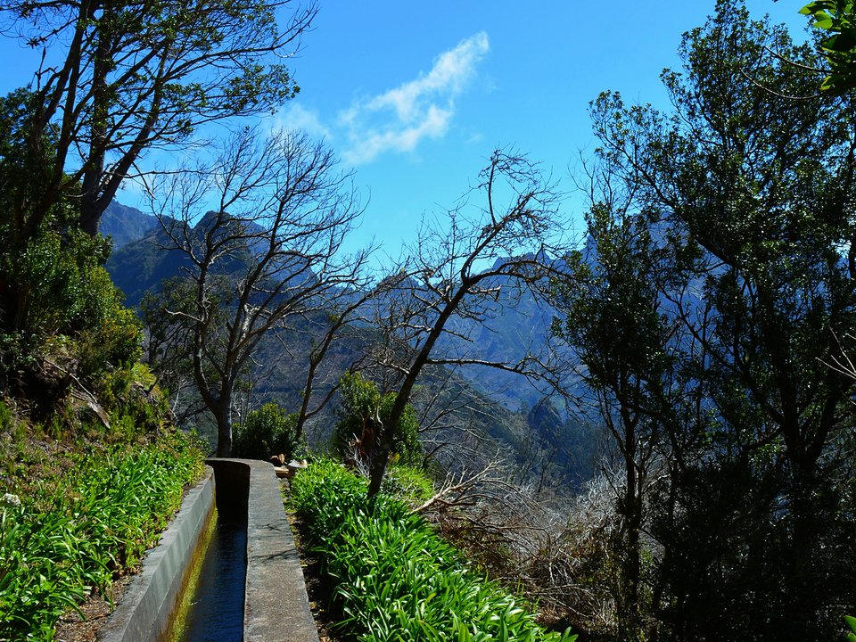
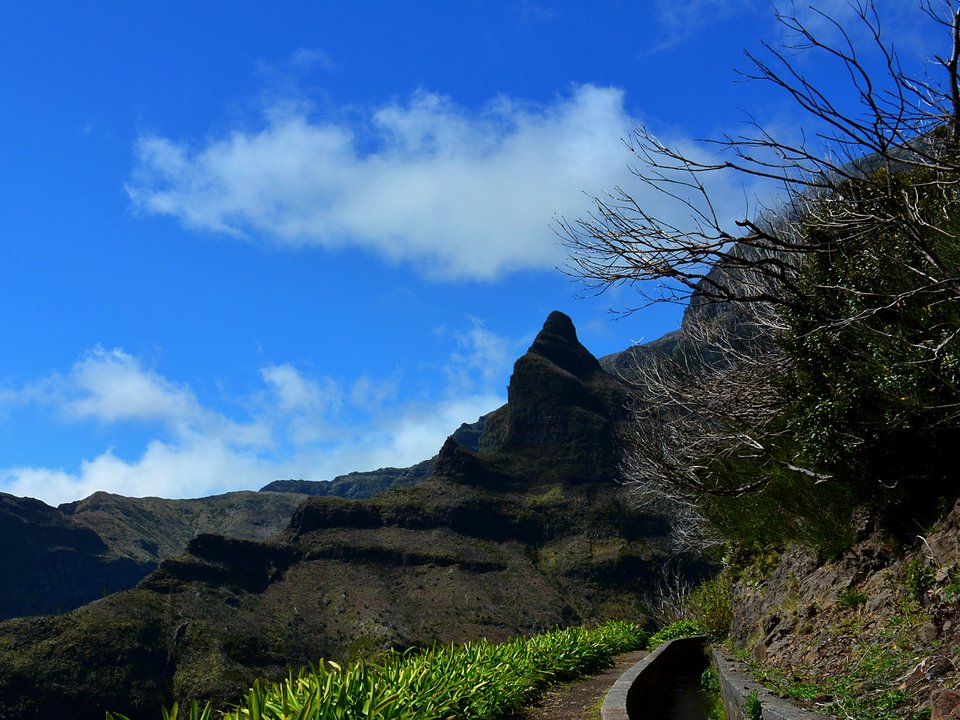
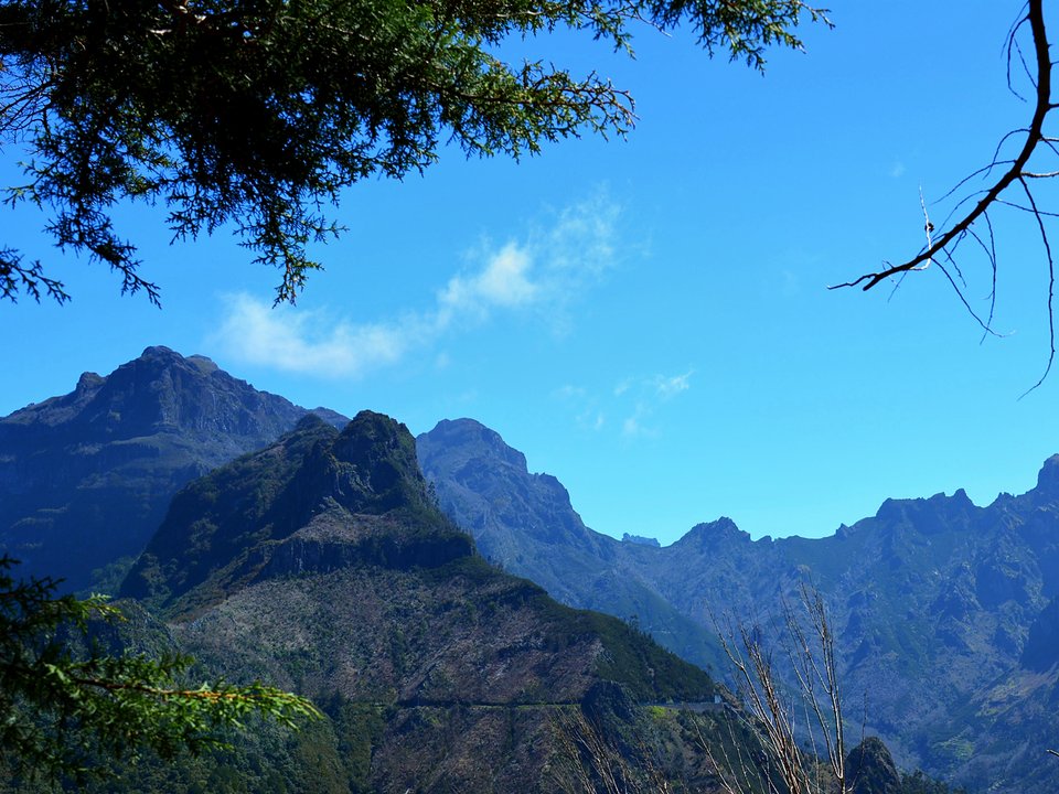
Tracing a historical corridor across Ribeira Brava, Levada das Rabaças functions as an unpatrolled mountain levada alignment between Fontes das Rabaças, Sítio do Cascalho (1320 m) and Downstream Portal of the Levada do Norte Variant Tunnel, near Boca da Encumeada (993 m). Passing through tranquil woodland gullies and rural hamlets, the pathway provides a direct encounter with Madeira's working agricultural heartland. Because it does not form part of the classified PR network, no municipal authority maintains bridge integrity or clears washouts along this remote path.
Route Profile & Terrain Details
- Surface conditions underfoot: Surfaces along Levada das Rabaças feature narrow stone inspection ledges, packed clay berms, and irregular volcanic paving stones beside the watercourse.
- Vertical exposure and protection: Cliffside precipices fall away sheer on the valley side of the ledge; walkers must maintain balance without the aid of certified safety railings.
- Gradients and elevation profile: Gradients along the watercourse are virtually level, with elevation gain concentrated almost entirely on the initial access ascents.
- Water flow and tunnel conditions: Groundwater seepage drips from volcanic basalt shelves into the channel, creating wet walking surfaces and requiring a headlamp for tunnels.
Trailhead Access, Parking & Return Transfer
- Road approach and connectivity: Vehicular access to Levada das Rabaças links through the VR 1 highway, ER 104 into Serra de Água, and ER 228 over Encumeada, passing through municipal parishes before transitioning to narrow local access lanes.
- Trailhead parking availability: Hikers must rely on informal village laybys or church square parking, walking the remaining distance along the access road to reach the start.
- Public transit connections: Regional bus services via SIGA Madeira (West / Northwest) central corridor bus connections reach nearby district settlements, from which connecting walks or local taxis bridge the final gap.
- Return logistics and transfer options: One-way walkers should organize their transfer from Downstream Portal of the Levada do Norte Variant Tunnel, near Boca da Encumeada (993 m) prior to setting out, while drivers typically turn around at a natural midpoint.
Channel & Waterworks Context
- Water intake (Madre): Fontes das Rabaças, Sítio do Cascalho (1320 m)
- Terminus (Fim): Downstream Portal of the Levada do Norte Variant Tunnel, near Boca da Encumeada (993 m)
- Total hydraulic channel length: 7 km
- Catalogue record: Levada das Rabaças
- Catchment character: Conveys fresh spring water through dramatic ravine contours, supplying municipal irrigation basins and agricultural storage tanks downhill.
Carved into the sheer volcanic cliffs of Ribeira Brava, Levada das Rabaças was established to gather water from inaccessible river headwaters and distribute it to downhill settlements. Craftsmen faced immense danger negotiating sheer precipices, cutting stone aqueducts across treacherous gullies and constructing sturdy retaining buttresses to prevent winter landslides from rupturing the conduit. Preserving this historic waterway maintains a vital link between upland springs and coastal agriculture, providing walkers with a direct glimpse into Madeira's time-honored communal water distribution culture.
Field Safety & Official PR Alternatives
A journey along Levada das Rabaças presents rustic, unpatrolled trail conditions that demand heightened vigilance throughout Ribeira Brava. Rigid-soled hiking shoes with aggressive tread are indispensable for maintaining stability on narrow ledges. Bring reliable headlamps with spare batteries, offline GPS tracks, a windproof shell, and sufficient hydration. Should heavy mist reduce navigation visibility or trail footing become dangerously slick, abort the hike and retreat along your inward path.
Official classified PR alternatives near Ribeira Brava
Walkers seeking reliable footing, signposted junctions, and dated condition updates across Ribeira Brava choose one of these maintained classified PR trails over Levada das Rabaças:
- PR 17 Caminho do Pináculo e Folhadal — 15 km table route between Bica da Cana and Encumeada above Ribeira Brava (listed partly open between Bica da Cana, Caramujo, Folhadal, and Encumeada on the 2 October 2026 IFCN table). Provides a maintained forest route starting near paved access roads and accessible trailhead parking with clear directional signage.
- PR 1.3 Vereda da Encumeada — 11.2 km table ridge route starting at the Encumeada pass above Ribeira Brava (listed partly open between Boca das Torrinhas and Encumeada on the 2 October 2026 IFCN table). Features an officially surveyed walking route with regular ranger monitoring and reliable cable protection beside steep ravine precipices.
Additional unmanaged trails documented within Ribeira Brava comprise Levada da Corujeira (Tabua) and Levada da Serra de Água, listed in the unknown trails index without official PR status. Field record for Levada das Rabaças: Public Madeira waterworks surveys and municipal heritage archives, contrasted with IFCN Percursos pedestres classificados (updated 2 October 2026, read 12 October 2026).
Specifications & facts
- Type
- Levada
- Area
- Ribeira Brava
- Difficulty
- Not printed
- Distance
- 7 km (channel length)
- Time
- Not printed
- Elevation
- 327 m drop (1320 m to 993 m)
- Start
- Fontes das Rabaças, Sítio do Cascalho (1320 m)
- Finish
- Downstream Portal of the Levada do Norte Variant Tunnel, near Boca da Encumeada (993 m)
- Water intake (Madre)
- Fontes das Rabaças, Sítio do Cascalho (1320 m)
- Terminus (Fim)
- Downstream Portal of the Levada do Norte Variant Tunnel, near Boca da Encumeada (993 m)
- Channel length
- 7 km
Post-Hike Refuel & Dining Radar
Authentic Post-Hike Hospitality
Trailhead & Village Refuel Radar
Nothing defines Madeiran hiking culture more authentically than gathering at a rustic mountain bar or fisherman's tasca right after the trek. Verified local venues within minutes of the finish:
Tasca da Serra
Field photographs along the channel