FAJÃ DA AMA – RIBEIRA DO INFERNO · Fajã da Ama → Ribeira do Inferno
PR 16 · PR 16 LEVADA FAJÃ DO RODRIGUES · FLAT CANAL · IFCN €4.50
PR 16 Levada Fajã do Rodrigues
MODERATE (LONG UNLIT TUNNEL) · FAJÃ DA AMA – RIBEIRA DO INFERNO · 3.9 KM EACH WAY (7.8 KM THERE AND BACK)
Also known as: Levada da Fajã da Ama
Fajã da Ama
Start Car Park · IFCN €4.50
Ribeira do Inferno
3.9 km each way · Open Both Ways
Exit Terminus (Ribeira do Inferno)
7.8 KM Total Route
Retrace to Fajã da Ama
Alternative out-and-back · Avoids taxi transfer
OPTIMAL WINDOW: 08:00 - 10:30 FROM FAJÃ DA AMA — SHADED LAURISSILVA CANOPY; EXPECT DAMP LEDGES
4 BASALT TUNNELS (LONGEST 1000M) — DEDICATED HEADLAMP REQUIRED & WATERPROOF FOOTWEAR
BOOK OFFICIAL IFCN SIMPLIFICA PERMIT (€4.50) ONLINE BEFORE ARRIVAL
Distance
3.9 km each way (7.8 km there and back)
2 h 30 min – 3 h 00 min · +60 m / -60 m (580 m – 600 m)
IFCN Fee
€4.50
Return to Car
Returns to starting car park
Area / Difficulty
Fajã da Ama – Ribeira do Inferno · Moderate
Status note. IFCN, 25 October 2026: Open, 3.9 km each way. Field Equipment Advisory: The 1 km unlit tunnel features permanent waterfall runoff from the tunnel ceiling and deep puddles; a waterproof shell and 300+ lumen headlamp are essential. Updated 25 Oct 2026.
PR 16 Levada Fajã do Rodrigues is open, 3.9 km each way. Field advisory: permanent tunnel ceiling waterfall splash requires a waterproof shell and 300+ lumen headlamp.
Notices still inside their window
Checking notices.
Interactive Field Calculators & Logistics Tools (Shuttle, Cost, Microclimate & Offline Card)
Closure & Congestion Mitigation
Twin-Trail & Plan-B Engine
If parking is saturated or weather conditions deteriorate at PR 16 Levada Fajã do Rodrigues, these nearby alternative routes share the same terrain character and offer verified open conditions.
PR 18 Levada do Rei
Lush UNESCO Laurissilva waterworks alternative
PR 10 Levada do Furado
Classic cliff-carved irrigation channel with protected railings
Field Logistics Intelligence
Return-to-Car & Linear Loop Solver
Self-contained vehicle loop: this route safely returns directly to your starting parking bay at Fajã da Ama.
Self-Contained Vehicle Return
This trail is an out-and-back or circular loop that terminates at the same parking area where you started (Fajã da Ama). No taxi, public bus transfer, or multi-car shuttle required.
Coordination & Taxi-Split Action
Send this verified return plan to your group via WhatsApp or SMS.
Field Hazard & Body Impact Intelligence
Reality Matrix: Tunnels, Vertigo & Knee Strain
Beyond generic difficulty ratings: quantitative engineering metrics on pitch-black irrigation tunnels, abyss exposure tiers, and knee-joint impact on steep Caminho Real cobblestones.
1000 m
Longest underground passage
Hands-free headlamp is required: smartphone flashlights leave only one hand free for wet 45 cm canal ledges and risk dropping phones into the channel.
Tier 2 · Moderate Exposure
Cliff-clinging canal ledge into the Ribeira do Inferno with dramatic waterfalls.
Not recommended for hikers with severe acrophobia or vertigo sensitivity.
Level 1 · Gentle Canal Bank
Flat watercourse walk; challenges are low tunnel ceilings and water flumes.
Flat levada bed protects knees and hip joints from cumulative descent trauma.
Atlantic Microclimate Intelligence
Live Island Clock & Microclimate Advisor
Simulate your planned departure hour to beat the cloud inversion ceiling, trade-wind fogs, and trailhead parking saturation.
Prime trail window: 08:00 - 10:30
Trailhead Parking
Ample · Laybys empty
Cloud Ceiling Risk
Clear skies · Above cloud sea
Trail Congestion
Very Light · Trail to yourself
Sun & Wind Load
Cool & Crisp · Light windbreaker
24–48h Post-Rain Saturated Basalt Advisory
24–48h Post-Rain Advisory: Saturated volcanic basalt fissures retain heavy hydraulic pressure for 24–48 hours post-rainfall. Heightened rockfall danger in deep canyons.
Field advisory: Coastal maritime microclimate; protect against morning sun and changing sea breezes.
2026 IFCN & SIMplifica Tariff Engine
Permit, Parking & Transfer Cost Estimator
Calculate your exact party outlay under the 2026 SIMplifica regulatory regime, including legal resident and child exemptions, parking caps, and return transit.
Adult Hikers (> 12 years)
Standard permit €4.50
Children (≤ 12 years)
100% Legally Exempt (€0.00)
Madeira / PT Residents
100% Resident Exemption (€0.00)
Forest Police (Corpo de Polícia Florestal) inspect digital tickets at trailheads. Fines of €50–€500 apply for unregistered hikers.
Offline Survival Pocket Card: PR 16 Levada Fajã do Rodrigues
Essential route facts and offline navigation notes for remote terrain with zero cellular signal
Start Trailhead GPS
32.8280° N, 17.2050° W
Fajã da Ama · 580 m elevation
GPS: 32.828, -17.205
Finish / Terminus GPS
32.8180° N, 17.1880° W
Ribeira do Inferno, then back · 600 m elevation
GPS: 32.818, -17.188
Distance
3.9 km each way (7.8 km there and back)
Estimated Time
2 h 30 min – 3 h 00 min
Elevation Profile
+60 m / -60 m (580 m – 600 m)
Difficulty Grade
Moderate (Long Unlit Tunnel)
Emergency SOS & Civil Protection
112 — European Emergency SOS (Universal)
Civil Protection (Proteção Civil): +351 291 700 112
IFCN Forest Police (Polícia Florestal): +351 291 102 700
VHF Marine Ch. 16 / Mountain SAR
Rule:Cardinal Survival Rule: Stay strictly on the levada path. Never descend into stream gorges or waterfalls. If cloud ceiling descends, halt and wait in place.
Car park check
Pick the car park where the car stays. These lines are the table checked on 25 Oct 2026.
Both ways · 3.9 km each way
Fajã da Ama → Ribeira do Inferno
You can walk this section and come back to Fajã da Ama.
Fee figure on the checked table: €4.50.
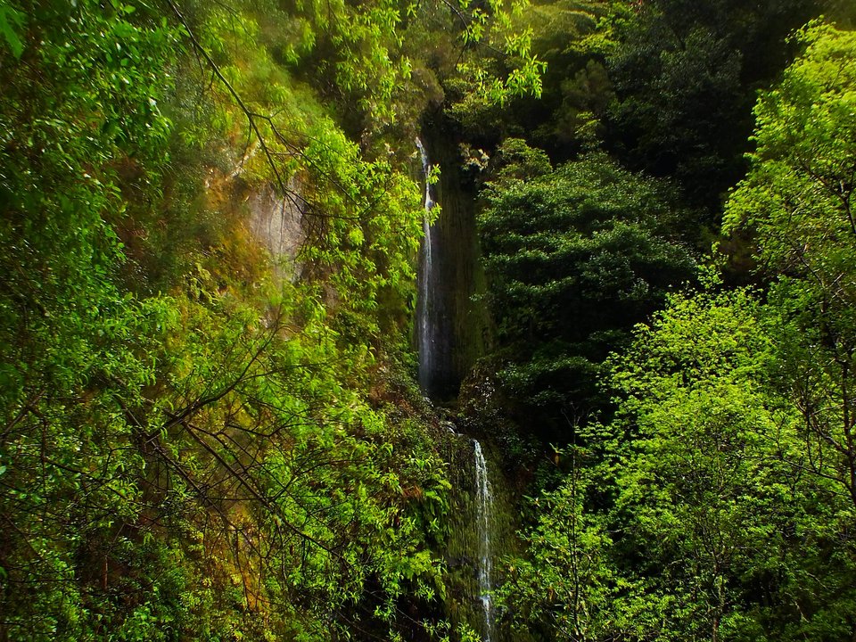
PR 16 Levada Fajã do Rodrigues is on the IFCN classified-trail table verified on 25 October 2026. The official distance on that table is 3.9 km each way (7.8 km there and back). The places named there are Fajã da Ama and Ribeira do Inferno. The status on that table is: open. Route Summary: 3.9 km each way (7.8 km there and back) · 2 h 30 min – 3 h 00 min · +60 m / -60 m (580 m – 600 m) · Moderate (Long Unlit Tunnel) · Out-and-back returns to car. Located in the green northern valley of Ginjas in the municipality of São Vicente, PR 16 is an out-and-back levada walk famous for its sequence of long, rock-cut tunnels, cliffside waterfalls splashing directly over the walkway, and deep views into the Ribeira do Inferno gorge.
Out-and-back logistics and parking at Fajã da Ama (Ginjas)
Because PR 16 dead-ends at the water intake (madre da levada) in the upper Ribeira do Inferno canyon, every walker returns along the same channel to the starting point at Fajã da Ama:
- Road approach: From the centre of São Vicente, drive inland toward Ginjas and follow the steep, narrow local road signs up to the Fajã da Ama trailhead.
- Parking: Roadside parking near the start of the levada is narrow and limited. Arrive early in the morning, park tight to the verge without blocking farm driveways or turning spaces, and use low gear on the steep approach lanes.
- Public transport: Buses serve the main São Vicente valley floor below, from where a local taxi is the easiest way to reach the upper Fajã da Ama start if you do not have a car.
Tunnels, waterfalls, and essential kit
Do not start PR 16 without a proper torch and a waterproof jacket, even on a dry sunny morning:
- Long, dark tunnels: The second half of the 3.9 km outward walk passes through a series of unlit tunnels blasted through solid basalt — including one tunnel stretching for nearly a kilometre with curves that block daylight completely. Permanent waterfall runoff cascades directly from the tunnel ceiling, creating deep puddles and wet rock benches. A dedicated 300+ lumen headlamp (plus spare batteries) is mandatory; phone lights are inadequate for the uneven, waterlogged tunnel floor.
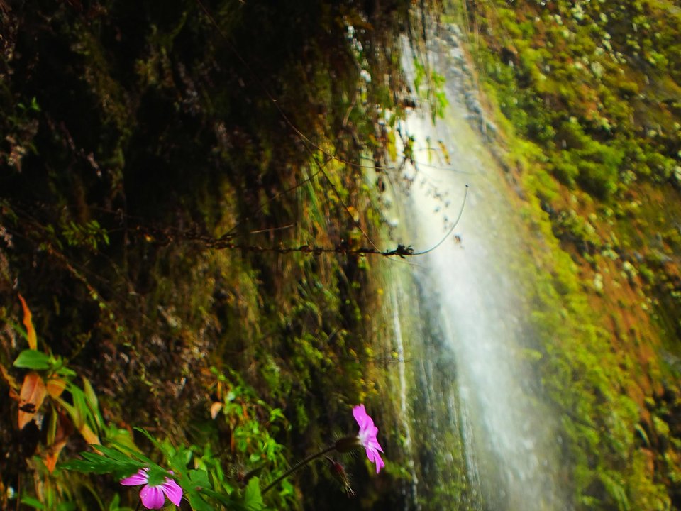
- Waterfalls over the path: Between the tunnels, streams cascade down vertical canyon walls right onto and across the narrow concrete levada ledge. A hooded waterproof shell jacket and shoes that handle ankle-deep splashes and wet stone are essential to keep your core warm in cold subterranean draughts.
- Vertigo and railings: The open stretches between tunnels contour high above the Ribeira do Inferno ravine behind post-and-wire fencing. Walk single-file and let returning hikers pass at wider rock bays before entering narrow tunnel portals. Full packing advice is in What to carry on a levada.
Before you go
Because the upper channel toward Ribeira do Inferno runs through three long, water-dripping tunnels where a 300+ lumen headlamp and waterproof shell jacket are mandatory, check your lighting gear at Ginjas before stepping onto the levada. The IFCN fee FAQ lists €4.50 per person for one classified route other than PR 1. Residents of the region, children aged 12 or under, and covered disability cases do not pay the fee and still need a reservation; see PR trail fees and reservation rules on Madeira. This site does not publish a live forecast. Source: Percursos pedestres classificados, table verified 25 October 2026. The fee figures are from the IFCN fee FAQ.
Channel history and waterworks notes
- Water intake (Madre): Ribeira do Inferno (600 m)
- Terminus (Fim): Sítio do Loural, São Vicente (570 m)
- Total hydraulic channel length: 6.5 km
- Traditional and local names: Levada da Fajã da Ama
- Engineering and basin context: Mid-20th-century CAAHM rock-gallery and tunnel conduit tapping the upper Ribeira do Inferno gorge to irrigate Ginjas, Fajã do Rodrigues, and Loural in São Vicente.
Inaugurated under the mid-twentieth-century hydraulic works of the Comissão Administrativa dos Aproveitamentos Hidráulicos da Madeira (CAAHM), Levada da Fajã do Rodrigues (historically also called Levada da Fajã da Ama) captures the cold headwaters of Ribeira do Inferno at 600 m deep in the São Vicente mountains and runs for 6.5 km through a series of long rock-cut tunnels and cliff-cut galleries to Sítio do Loural (570 m) in São Vicente, irrigating the agricultural slopes of Ginjas and Fajã do Rodrigues; PR 16 follows its 3.9 km upper gallery section.
Specifications & facts
- Type
- PR route
- Area
- Fajã da Ama – Ribeira do Inferno
- Difficulty
- Moderate (Long Unlit Tunnel)
- Distance
- 3.9 km each way (7.8 km there and back)
- Time
- 2 h 30 min – 3 h 00 min
- Elevation
- +60 m / -60 m (580 m – 600 m)
- Start
- Fajã da Ama
- Finish
- Ribeira do Inferno, then back
- Water intake (Madre)
- Ribeira do Inferno (600 m)
- Terminus (Fim)
- Sítio do Loural, São Vicente (570 m)
- Channel length
- 6.5 km
- Also known as
- Levada da Fajã da Ama
- Return
- Returns to starting car park
- Fee
- €4.50
Post-Hike Refuel & Dining Radar
Authentic Post-Hike Hospitality
Trailhead & Village Refuel Radar
Nothing defines Madeiran hiking culture more authentically than gathering at a rustic mountain bar or fisherman's tasca right after the trek. Verified local venues within minutes of the finish:
Tasca da Serra
Field photographs along the channel